Good Thursday, friends and neighbors. Our fall feel rolls on for a few more days as we track the return of rain chances to the bluegrass state. The threat for showers and storms will slowly increase this weekend into early next week That’s some great news because we can certainly use some more.
Let’s start with the chill in the air before we get to the rainy stuff.
Temps this morning will likely drop into the 50-55 degree range for many areas and records are in jeopardy, again. Track it all through the Kentucky Mesonet…
Today’s Lows

Current Temperatures

Highs this afternoon may tickle 80 in the west and south with many areas in the mid to upper 70s. Skies will be partly sunny with more in the way of low humidity. In a word… perfection.
Moisture begins to increase on Friday. That’s when some showers will slowly develop later in the day with temps from the upper 70s to low 80s. Rain chances should increase into Saturday and Sunday as low pressure moves our way from the southwest…
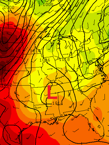
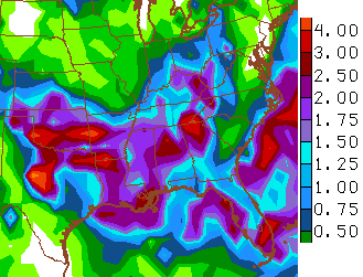
The models have been waffling back and forth on a lot of rain verses just a small amount of rain. The GFS has been the worst of the bunch. One of the runs from Wednesday was showing this…
 Other runs had pretty much nothing. Treat the GFS like you treat in during the cold weather season because that’s how this pattern looks. The model has some real issues in how it handles energy.
The clouds and rain chances will help keep temps below normal through the weekend and into the early part of next week.
A heads up for those who like to look farther down the road… I will be doing just that this weekend. Will El Nino develop? How do the seasonal models look as we head toward Fall?
Enjoy the day and take care.

We were chillier this morning. Recorded 52 degrees here near Pikeville.
Talking about lows, the historic low was 50F in 1967. The low this morning was 47F.. it felt like Scotland in July!
Record lows in Paducah, Frankfort, and Jackson
The way it’s looking frankfort might get record low rainfall for July also!
Record low in Nashville TN; 57 degrees this morning.
Also 57 yesterday morning.
Nice to have the windows cracked open and hearing the katydids (or “tree frogs”) during the night. Great to save on the AC bill.
Dewpoints fell into the 40’s for a time today in most of Kentucky. That is awesome for Mid July!
The HPC 7 day precip is looking more and more pitiful for cent KY. But that’s OK. I’m glad the Witchita Falls area finally got 2 plus inches of rain..They were soooo dry..
I’m actually liking our rain chances.
Chris can I get a promise on that???
No matter what happens your the best, thanks for the positive thinking anyway 🙂
Sorry… the rain will stop at the Franklin county line. 😉