Good Saturday to one and all. Rain and thunder is kicking off the weekend for much of the bluegrass state. This is all part of a pattern that looks and feels more like fall instead of July. Guess what? We’re not done with the cool blast of air!
Let’s hit the rain prospects before we get to the temp setup. Occasional rain and some thunder is likely today across central and eastern Kentucky. Heavy rain is likely into southern and eastern Kentucky and some areas could pick up 1″-2″. Lighter totals will be noted across the north and west.
Scattered showers and thunderstorms will be around to wrap up the weekend on Sunday… especially in the central and east. Highs will return to the 80s.
Scattered showers and storms will be around into the first half of next week as temps try their best to get to normal summertime readings. Another dip in the jet stream will bring another shot of cooler air by the end of the week…
That won’t be nearly as cool as where we’ve been of late, but will give us 80-85 degree readings with some sun and slightly cooler with some rain.
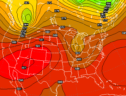
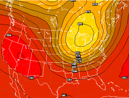
That looks to be followed up by an even bigger push of cool air late next weekend into early the following week…
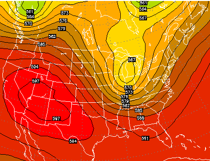
Heck, even the GFS has this one…
 Let’s track today’s weather…

Rainfall

Current temperatures

Have a great Saturday and take care.

Yesterday’s official high at Lexington was 72°F, the last time we’ve had a high of 72 or lower was May 18 when the high was 66°F! So it’s been exactly 2 months since we have experience a high temp that low! A bit crazy when you think about it because you wouldn’t expect to have beated it until September, not mid July. Also, we’re running 2.3° below normal so far for July, compare that to July 2009 which was 4.1° below normal.
Not a peak of sunshine here today.72 degrees at the moment.Looks like we won’t go above 75 since its already after 2pm.It has misted rain most of the day too.It is damp and dreary but its cool.
I expect the warm up will arrive soon. The Weather Channels official high for yesterday was 70 but only made it to the mid 60s on my thermometers.
Got about .40 inch of rain yesterday in east frankfort, was hoping for more today but that looks unlikely now, maybe more in the next day or so?
Heating degree days in July? Ugh… No thanks!!
Enjoying the below normal readings of late. Precip needs to follow suit.
We have had some good rain here in the northeast. I don’t mind a rainy day now & then….the lawns, gardens, and flowers are looking great. Hate that some people might have had some outdoor plans scuttled, but we sure needed the rain. Hope everyone enjoys the rest of the weekend.