Good Friday, folks. Rounds of showers and thunderstorms are rumbling across the commonwealth of Kentucky. This action will carry us through the weekend and will deliver heavy rainfall numbers to many areas. This could be enough to cause some local high water issues. Oh yea… it gets cool again next week.
Many areas should see around 1″ of rain through Sunday. Much higher amounts are possible and those are the spots we will need to keep a close eye on. The rain and storms will come at us in waves with some breaks in between. Highs may not get out of the 70s for several cities during this time.
Track away…
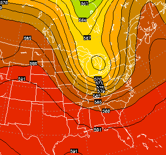
Current temperatures


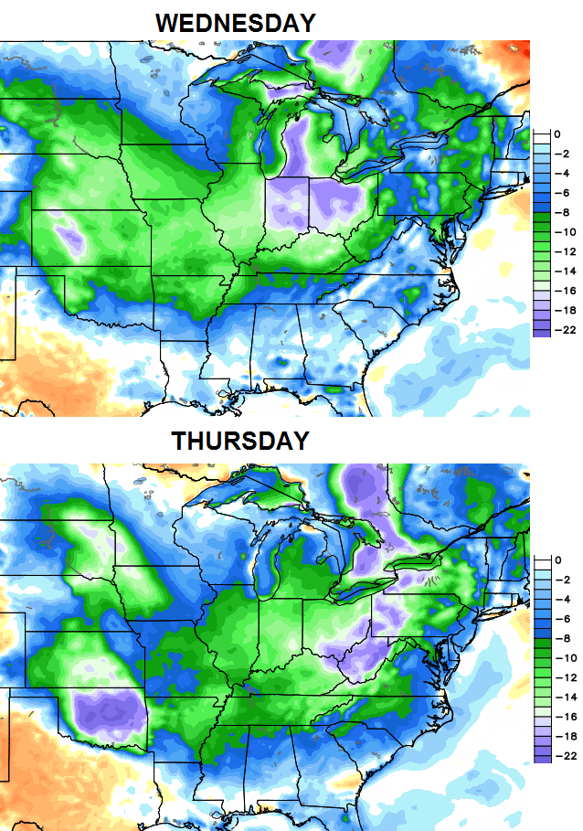
Scattered showers and storms will carry us into the first half of next week. That’s when we start to see another deep trough digging in across the region…
 Below normal temps continue to rule the roost…
 Check out the 5 day average departures in Celsius from the GFS Ensembles…
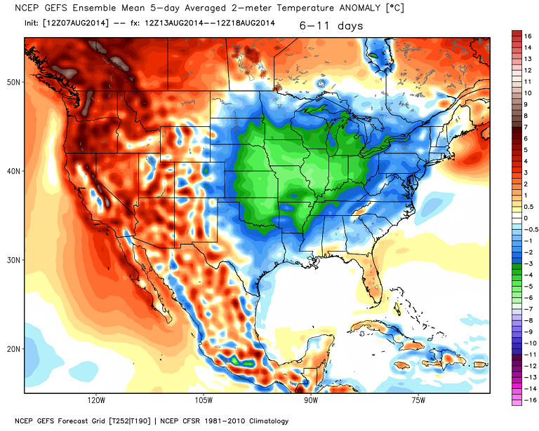 That takes us to the 18th day of the month and likely ensures another colder than normal temperature month for many areas.
The weather pattern since last summer has been among the easiest I’ve ever seen to forecast. I’m not talking about individual systems, but the overall pattern.
Have a great day and take care.

Extended, easy weather patterns are good for you CB. They will allow you to recharge your batteries for the coming early winter! Can we beat the October 21st start from last year? I think so!
However, let’s hope Berea doesn’t have another December where it has less snow than October. Those forecast versus actual results for us were brutal and I’d rather not go through that again.
If it makes our friends in WKY (or my own trees) feel any better, this is what a real drought looks like…
http://www.latimes.com/science/la-me-g-california-drought-map-htmlstory.html
The new trend at my house in Valley Station is now either sprinkles or downpours, 2″ or not measurable.
Timing was perfect…beginning of rush hour, lots of accidents around the Metro Louisville area.
Thats odd 2 weather systems in a row where SW Jefferson County has received more rain then central and eastern Jefferson County.
Maybe a new trend…now, if that can carry over to winter, maybe I’ll get more snow than them too.
Not a peek of sunshine here all day.Temps have stayed in the 70s.Humidity is up a bit but not to bad if you aren’t having to work in it.Have stayed comfortable all day just using the fans.Everything seems soaked but most the rain was last night.Mainly very light today or mist like.Looks as if it is going to stay overcast.
Radars show hit and miss showers all around.
The radar most of today has looked more isolated than widespread. The NWS weather map for today had a lot of KY in a flood risk.