Good Friday to one and all. We’ve made it to the end of the week and we’re ready to kickoff the weekend with gorgeous weather. This won’t last very long because another stormy pattern is about ready to take shape. The action starts later this weekend and looks to carry us through next week.
Highs today will range from the upper 70s to low 80s with a mix of sun and clouds. Overall… today is fantastic!
Saturday will find temps from 80-85 in many areas with some high clouds on the increase. I can’t rule out a stray storm or two in central and western Kentucky. The European Model shows my concern…
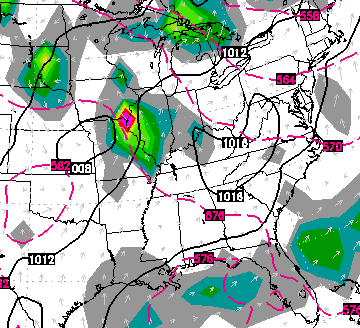
The best threat for showers and thunderstorms will roll in later Sunday into Monday. That’s when low pressure slowly works across the region…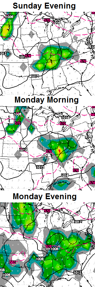
That is likely to be followed up by another system by the middle of the week…
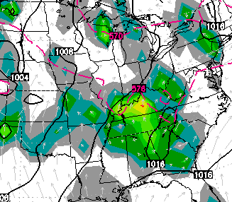
All of this is happening as warm and humid air pushes in from the southwest. Instead of turning our weather hot… we get in on rounds of showers and thunderstorms through next week. The European Model continues to show significant totals…
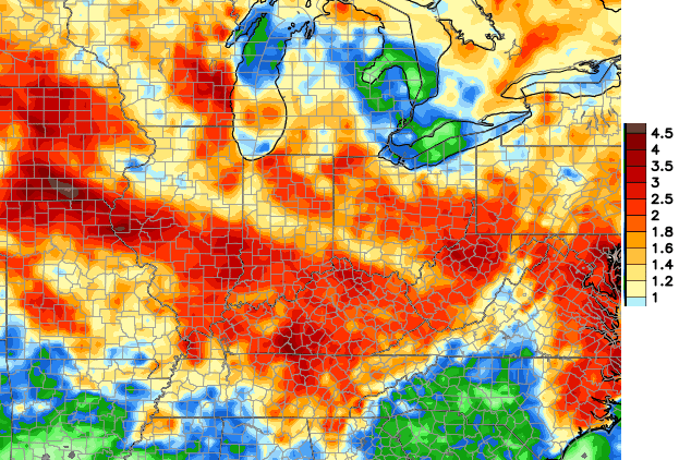
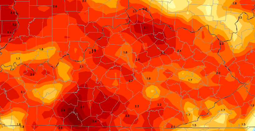 This is a setup that can unload on some areas with torrential rainfall. When and where will be the big questions as we roll into this period.
Have a great Friday and take care.

Dew point 39 in Campbell co. Dew point 69 in Owsley.. HUGE difference in the way it feels out..
Dew point was 32 in Campbell, just ticked up to 36 at 4pm.
That’s one of that make you remember the movie Friday
(“daaaaaaaaaaaaaaammmmn”).
Looking across the Mesonet map, the ranges for dew points are scattered all over without a real pattern for the state. Odd to see without a system moving through of some sort to push one way or another.
Even Nashville’s dew point dropped to 53 yesterday. Currently 88 air temperature but dew point temp still only 59.
My wife and I recently bought a starter home that happened to have a big central whole house fan in the hallway ceiling. Other than being somewhat loud and if anything a bit too powerful (we have to tie down some drapes), the fan is great on hot days with low dewpoints. We don’t have to run the AC as much.
My sister has one of those in her house. It’s awesome. Completely circulates the air from the outside in. Every house should come with one as standard.