Good Monday to one and all. Tropical air works into the bluegrass state this week and this will aid in the development of rounds of showers and thunderstorms. In between these rounds, temps are going to turn rather toasty… especially in the west.
A huge ridge of heat is developing across the plains states over the next few days. This will put Kentucky on the fringe of the real deal heat, but some of that could slip into western parts of the state. Rounds of showers and thunderstorms would come calling to central and eastern Kentucky. Here’s the setup…
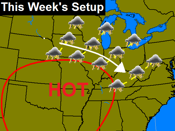
This is going to make for a rather busy period for our region. Here’s a breakdown:
– Let’s start in the west where heat and humidity will be the main show. This is a part of the state that has a very dry ground and that will allow temps to soar well into the 90s. Heat index values of 100+ will be possible.
– Central and eastern Kentucky will be dealing with rounds of showers and storms. These storms will likely put down torrential rainfall and a round or two of severe storms will be possible. Big storms like to crank up along the periphery of heat domes. Watch for local high water problems.
– Temps in the central and east are not as clear cut as the west. This area has a very wet ground with lush vegetation and will also be dealing with storms. Any day that doesn’t feature much in the way of storms will turn toasty and could hit 90. Regardless of the temps… this is a steam bath of a week with the high humidity levels.
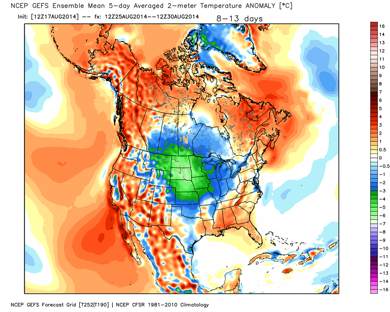
This pattern isn’t going to hang out long as it is likely to be replaced by another trough next week. The GFS Ensembles show the cool coming…
Here are today’s tracking tools…


Have a great Monday and take care.

Well I am not looking forward to the high humidity levels but I suppose we have had such few real warm days we can’t complain to much.By the time the week is over I will be ready for cooler days again.
Have some light rain going on now but doubt we even got 1/4 inch during the last 24 hours.Seems like a good week to stay in the AC if possible.Hoping no one gets storm damage and power outages from any of this.
Serious flooding in Perry and Knott Co. Had to be a swath of 2-4 in. Rain come through here..
Chris, where is the 24 hr rainfall total chart?
We’ve had 1/4 of an inch since midnight last night. We had maybe half an inch all of last week; now we are under a flash flood watch for Carter & Boyd. We will probably “watch” it go south again. Sure don’t want floods for anyone. Hope everyone stays safe.
These flooding pictures that CB has been retweeting are crazy.
Very little rain out their today, models over doing it again!
Looks like there might have been a very brief EF0 or EF1 twister yesterday in Henderson County, KY. NWS Paducah will conduct a storm survey tomorrow at the scene to verify, but both radar and a photo show an apparent tornado.
However, it’s good to keep in mind that the tornado threat in our part of the country this time of year is generally low, but as we have seen the flash flood threat isn’t. Please be safe everybody.
Well its been pretty much dry as a bone in Harlan all summer the storms always break up as they make it our way. Fun under the dome!