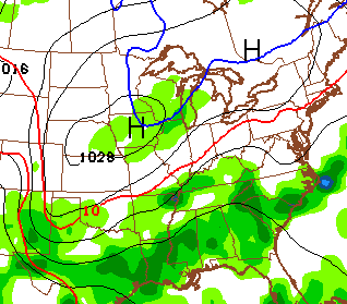
Good Thursday, folks. A powerhouse of a cold front is rolling across Kentucky and is bringing some big time weather changes. Showers and thunderstorms continue to be ahead of this front, but the blast of fall is making headlines behind it.
Let’s start with the shower and thunderstorm threat and roll from there. Heavy rainfall is a good bet and this is likely to cause some local high water issues. Drier and cooler air moves in from west to east later today into tonight. I’ll have your tracking tools in a bit.
I have made some changes to your Friday forecast. The shower maker I have been hawking for Saturday may arrive a little earlier than I thought. That means scattered showers could be around on Friday…
That could keep temps down into the middle 60s for areas with full clouds and showers. The threat for showers would hang around into a part of our Saturday. Highs should range from the upper 60s to low 70s.
Sunday looks good with similar temps with a mix of sun and clouds. Lows to start the day will likely be in the 40s and we could be there again on Monday.
Another system could bring a few showers our way late Monday into Tuesday. This ushers in a reinforcing shot of below normal temps for the middle of the week…
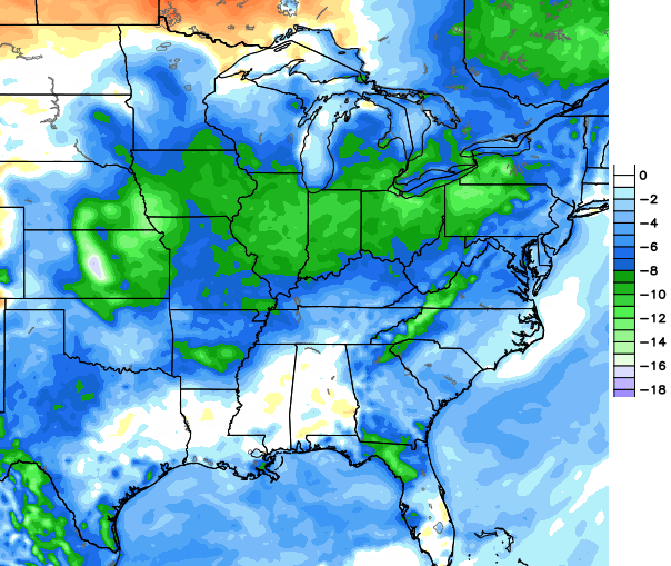
This cooler than normal pattern should take us through all of next week.
I promised you some winter weather talk and I am a weatherdude of my word… most of the time. 🙂 One of the things I look at when making a winter forecast is the water temperatures of the Pacific and Atlantic. They are HUGE drivers of the overall weather pattern across North America. There is a model that looks at the water temps and finds similar years and then spits out a forecast based on that data. Here’s what it shows for the fall and winter temps…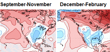 Keep in mind… there is a lot more that goes into the mix. But, it does show how the oceans are signalling colder than normal temps.
Back to the weather of today…
Current Temperatures


Current Temperatures
Have a great day and take care.

Chris, this matches up with other LR forecasts I’ve seen. One point that bears mentioning is the El Niño projection being downgraded from strong to weak. What effect do you feel the persistent warm ocean temperatures in the Gulf of Alaska and off the west coast of Greenland will have on any El Niño? Since the El Niño enhances precip in the Southeast, and the warm water enhances cold air flow, does this combine to add more white stuff for Kentucky? (I hope…))
After doing lots of reading and research for the upcoming winter, I think it will be one to remember.
It is really raining something fierce in Lexington right now.
Over 2.50″ rain at Louisville Int’l airport. I should know…I work out there. At least 8 waves of downpours with some lightning made for a long and wet night.
2″+ amounts common across Jefferson County. However, I’ve only received 1.40″ through 5:30am here in Valley Station. But, as I type this, moderate rain is falling again…
I must have been in the sweet spot as I ended up with about 4 and a half inches for the night. Incredible downpours that just kept going and going and going.
These are certainly very efficient rainers. PW must be off the charts.
September 11 setting one-day precipitation records for locations between Louisville and Lexington.
Speaking of records August came in at 11th wettest for U.S.
13th wettest for Kentucky
7th wettest for Central Kentucky Division
http://news.yahoo.com/summer-snow-colorado-calgary-canada-191614722.html
Picture 4 makes me feel like a lot of Southern transplants (top notch winter driving skills on display) must reside in Calgary.
I agree with the last pic 1000%. #toosoon
So what does cooler ocean temperatures mean for this part of the U.S.? Is it the warmer ocean water that causes or produces more snow for the eastern half of the country?
Come on down cool air! It’s still muggy here and 72 degrees. I see some areas have temps around 60, but it hasn’t moved in here yet. We did get some good rain today and I’m glad we did, because lately most of the rain seems to have missed us. If KY gets some big snows this winter I hope they don’t skip over or around us here in our NE corner.