Good Wednesday, everyone. We have a MAJOR weather change on the way later this week into the weekend. This will bring temps straight out of November and give us the potential for the first patchy frost of the season. If you’re a cold weather fan, that has to get your juices flowing.
The cold front is still on target to arrive on Friday. Widespread showers and thunderstorms will sweep in ahead of this…
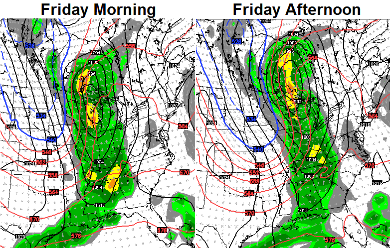
Heavy rains and gusty winds will make for a pretty ugly weather day across the region. Temps will be around 70 early in the day and then drop toward 50 for high school football action.
The cold air continues to push in on Saturday. It’s rare to see maps like these in early October…
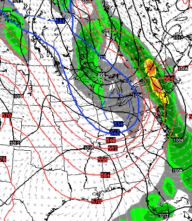
GFS
European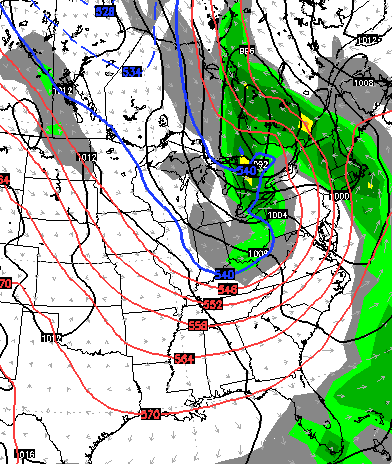
There is a small chance for a shower or two with another disturbance swinging in from the northwest. The temps will be the big story as many areas stay in the 50s for highs. The GFS is just flat out cold…
 That actually shows highs in northern Kentucky in the upper 40s! Throw in some gusty winds and it will feel even colder. Lows by Sunday may reach deep into the 30s and we could see some areas of frost…
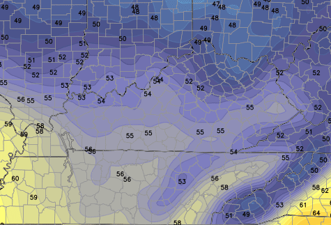
Another system dives in with chilly showers for Monday…
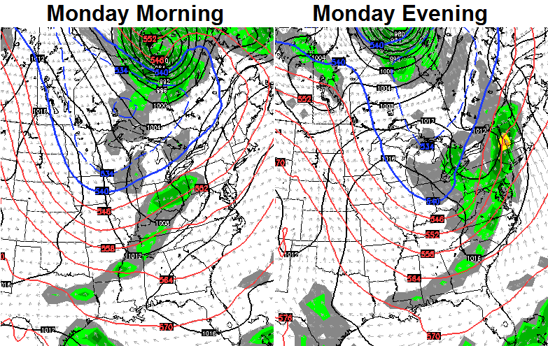 That’s a reinforcing shot of chilly air that keeps temps colder than normal into most of next week. Speaking of the next week, here’s a look at where the GFS thinks flakes could fall during that time…

I seriously doubt flakes would fly anywhere in the Ohio Valley, but that’s a lot of snow across southern Canada!
Are those cold weather juices flowing yet?
Make it a great day and take care.

Thanks Chris. Going to be great football weather it sounds like. Will this make our leaves turn faster or just pull them off the trees faster? Guess we will see. Have a great Wednesday everyone.
October seems to be showing up as the gateway to winter this year. This fall weather has been so nice, but I suppose things have to change if we want a cold and snowy winter….that is, if you want that. Maples are looking great across Laurel County…looking forward to more. Have a great day!!!!
Happy first day of Awectober! Love this beautiful weather!
Winter juices flowing. Trees are just starting to turn. Such a beautiful site to see.
Those temperatures for Saturday sound reasonable as we will be under the influence of air around low pressure to the north. If we get a period of sunshine, I would expect lots of clouds to develop well into the afternoon because of heating at the surface and colder air aloft, limiting any additional rise in temperatures.
October already, it snow last year in October????
yes…i think the 15th(ish)??
Just as long as this front brings some rain, I’m cool with a chilly Saturday. Louisville is in it’s longest stretch of no measurable rain since 1999. It was pretty dry here this summer and there were periods where things were looking really bad but nothing compared to right now. The ground is so hard that I’m not sure any rain would even soak in. Lots of trees just dropping leaves due to stress and I’m afraid we won’t have much color this month.
Make it rain Chris, I’m counting on you.