Good Saturday, folks. Our weekend of weather continues to look like the winner of the month of October. Mild temps and gusty winds will dominate the pattern for the next few days. That all changes next week as blasts of chilly air take aim at our region. There’s even the potential for an out and out very cold shot by Halloween weekend. Maybe some winter weather?
Oh yea… I will also have some longer range goodies for ya.
Let’s start with where we are now. Highs today should range from the upper 60s to low 70s with a mix of sun and clouds. Winds will be very gusty as a weak cold front works in. Can that front touch off a shower? The chances are very, very small, but it’s worth a mention.
Current temperatures


Sunday looks like another fantastic fall day as temps come down just a bit for some areas.
The final work week of October starts warm with temps surging well into the 70s for Monday. That warm air is ahead of a strong cold front that arrives Tuesday with a line of showers and thunderstorms…
 Gusty winds, showers and colder air will then carry us into Wednesday. Highs will come way down and be in the 50s. Those 50s should be around into Thursday.
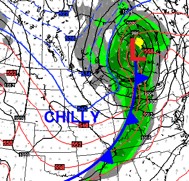
That’s when we focus our attention on the next system rolling in for Halloween weekend. The models have been all over the place with how to handle this possible cold shot and that’s to be expected.The European Model has gone all in on a stronger storm system…
 That would produce wintry weather around here if it verifies. That’s a very interesting solution that could be… yea. Anyway, it matches the European Ensembles from a few days ago.
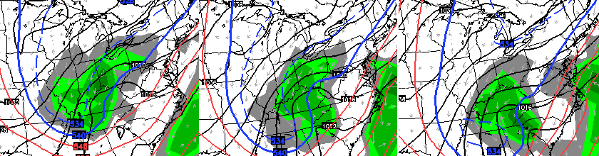
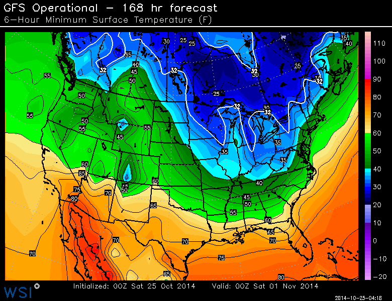
The GFS continues to advertise the cold and a touch of winter…
 Yes, that particular run shows some Halloween snowflakes being possible, but nothing like the European…
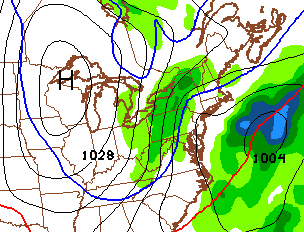
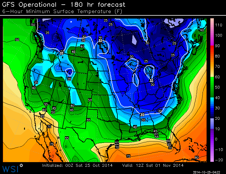
 Check out the temperatures for trick or treat time…
Saturday Morning lows are forecast to be deep into the 20s.
 That’s a heck of a way to say goodbye to October and hello to November. We still have a ways to go, but it’s certainly something for us to keep a very close eye on.
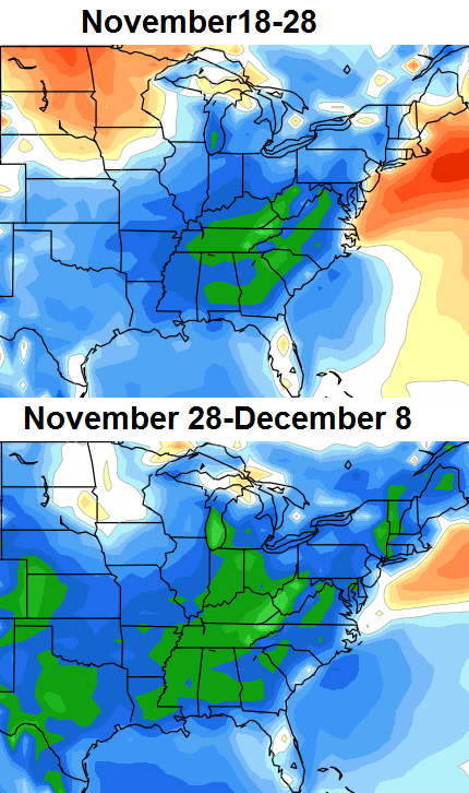
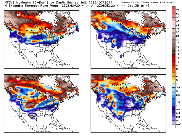
The seasonal CFS model continues to advertise colder than normal air coming from mid November into early December…
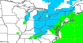
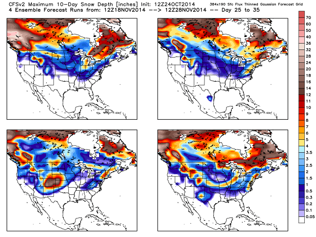
The corresponding snow numbers for each of those 10 day periods…
 It will be interesting to see if that model can remain consistent in the coming days as they usually bounce around a lot.
Have a great day and take care.

It quite commonly turns cold, with a dusting of snow sometimes, the weekend after Thanksgiving. I’m a mail carrier who has had to work that weekend for 18 years, so I REMEMBER.
I told u snow before oct was over. going be a OLD SCHOOL WINTER, its bout time!!!
Snow has not yet fallen so cool your jets.
I just don’t think there will be snow in October.Even with all the forecasts that say there is a possibility I can’t see it happening.At most there might be a flurry or two.
Seems like I recall it was windy and rainy during Halloween 2013.A few places had to change T or T days due to bad weather.
Super nice day today.Enjoying the little warm up before the cold sets in.Great to have days when no heat nor AC is needed.
Where the heck is the sun this morning!!!?
I swear, sometimes this area is like a MAGNET for cloud development!
This is great news! Birthday = 12/06.
ECMWF still looks like it’s over exaggerating a bit.
I remember a big snow on Halloween back in 95 or 96. It was one of those years. It was on Halloween night.