Good Thursday to one and all. Arctic air continues to dominate the weather pattern across the bluegrass state. November is on the way to becoming one of the coldest on record for parts of the region. We do have a very brief mild up that comes with a lot of weekend rain and wind, but the cold returns for Thanksgiving week.
Yet another blast of arctic air moved in last night and is with us today into Friday. Highs today will range from the upper 20s in the north to the mid and upper 30s in the far south and west. Gusty winds will make it feel even colder as a few snow flurries pass by.
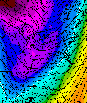
Current temperatures


Temps by Friday morning will drop into the teens for many with afternoon readings hitting the mid and upper 30s. Clouds will increase during the afternoon as milder air pushes in for the weekend. A few showers try to develop late Friday night into Saturday and the leading edge of those may contain a touch of sleet.
The milder air will be accompanied by a big wind and rain maker for Sunday as low pressure lifts northward to our west.

Heavy rain and thunder will be common as winds really crank up. Gusts to 40mph will be possible as that storm wraps up into Sunday night and Monday. Much colder air follows that up into Tuesday…
The cold looks to hold tough right on through the big Thanksgiving holiday weekend and travel period. Can we get some wintry weather with it? That’s certainly a possibility and one to keep watch on as we roll forward. The new GFS shows a clipper system unleashing another arctic blast…

That’s some very cold air pushing back in here behind that system…
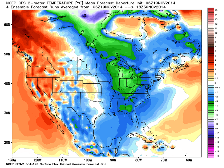
The renewed cold period for Thanksgiving week is backed up by the latest from the CFS. It shows temps well below normal through the end of the month…
The new run also shows a slightly colder than normal December…
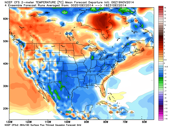
That changes around from run to run, but I actually think this run holds some merit with a back and forth month averaging slightly on the cold side.
The same model run likes the snow chances for the period that includes Christmas…

The winter forecast comes your way today at 5pm on WKYT-TV. Be there or get no snow this winter! 😉
I will have updates later today. Take care.

I live in Flatwoods n don’t get your channel. 🙁 But I hope u will still send plenty of SNOW my way this winter!
You can go to the wkyt.com website and see the weather videos on the site.I always seem to miss them on TV but I do go to the website and watch them later.
Thank you!
I am liking the December forecast as of now.
I am too.Also happy that Thanksgiving will be cool.The holidays don’t feel the same when we have warm temps for Thanksgiving and Christmas.That nip in the air just seems to make it feel more special.
39 for a low in Carrie of knott co last night, was nice not to have to thaw the work truck out
SE Ky kind of gets the shaft for weather forecasts. Wbir in Knoxville has been the most accurate. I emailed their weather guy Todd Howell and he was gracious enough to reply back with his thoughts for the next 2 weeks. So for areas around London, Corbin, Barbourville, Williamsburg, he says Thanksgiving day should be sunny highs around 47, Black Friday cloudy around 50. Turning cold on that Sat with highs barely reaching 40. He mentioned a big warmup around Dec 2nd or 3rd. Said don’t be surprised if temps hits mid to upper 60s. I love the next part – he said chances are looking like a white Christmas if what he sees plays out. Thought I’d share this with all down here in Gods country !!!!
Thanks Chris! Really looking forward to the winter forecast.
Chris,will you please put your winter forecast on this sight too please sir? Thank you for all that you do for us.
I love your enthusiasm.
(Meant for you, Chris Bailey, not the previous post!)
Up in the 40s here in Carrie of knott co. Cold air as a hard time taking hold in the mountains.