Good Thursday afternoon. The arctic front continues to SLOWLY push across southern and southeastern Kentucky. That’s allowing for temps in those regions to be several degrees warmer than areas to the north.
Current temperatures

Gusty winds are making it feel a whole lot colder than any of the numbers showing up. Teens show up again tonight in several places.
The forecast for the weekend continues to feature a big rain and wind maker rolling through here. Sunday looks just plain old nasty with the wind and heavy rains.
Arctic cold looks to return for Thanksgiving week. The first piece comes in behind the departing Sunday storm system, but it’s not as cold as what comes in over the long holiday weekend. The models continue to key on a system diving in from the northwest by Wednesday of Thursday.
The Canadian says it arrives on the busiest travel day of the year…
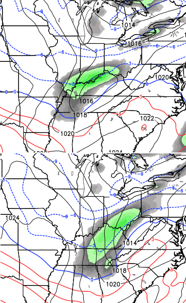
The GFS says Gobble Gobble…

A bigger system will try to develop later in the holiday weekend.
Enjoy the rest of the afternoon and take care.

Snow on Halloween….Snow on Thanksgiving…..(I’m dreaming of a WHITE Turkey Day)….Next….is Xmas…
Like the looks of the upcoming forecast.
Thanks CB for the update.
It has made it to 42 here today but the thermometer that is in back of the house is showing 38 in a shaded area.Still feels quit cool with the wind.Wind is much less today than yesterday for sure.
Very glad we will have cool temps for Thanksgiving.accuweather is showing us in the mid 40s for that day and mid 50s for Black Friday but I am thinking we will be cooler.
Regardless I am glad to get anything that is not extreme.
Cold temps will put everyone in the Christmas spirit on Black Friday,hopefully!
46 here in Carrie of knott co. Rather nice and sunny day
Nice turkey outline from GFS. Seems it has a sense of humor…
Alright – now that we are talking snow again, I am getting ready to warm up the “MPS” model (Mike’s predicted snowfall). Take the axis three days out and shift it 75 miles northwest. Oh, wait – it isn’t until next week… never mind… I will put the MPS away for a while…
Really enjoyed the winter forecast.
Looking forward to that double digit SNOW!!!
Please share info from the wkyt winter outlook….we here in carter co. do not get that channel. Thanks.