Good Sunday, everyone. We have some big winds on the way to the bluegrass state today into Monday. I’ve been setting this up for the past several days, but the winds look a little stronger than I thought. I wouldn’t be surprised to see some gusts nearing 50mph at times for a few areas. Moral of the story… batten down the hatches.
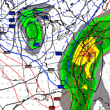
A strengthening area of low pressure works northward into the Great Lakes tonight and Monday. We’re on the mild and wet side of this system initially. Heavy rains will increase quickly today and some rumbles of thunder will be possible.

Sustained Winds

The Highest wind gusts are likely to come late tonight into Monday as the actual cold front moves through here. You can see how these gusts REALLY crank behind the front…

This is when temps begin to tank in just a matter of hours. Monday starts mild and ends with cold air returning…

The cold this coming week isn’t nearly as cold or extreme as what we just went through. Then again, what would be in November?
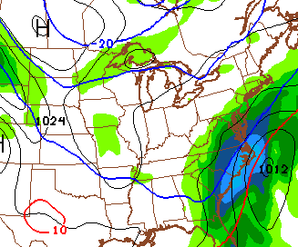
I continue to watch a potential east coast storm system from Wednesday into Thanksgiving. The European Model continues to brush southeastern Kentucky with some snow…
The GFS is now seeing the storm…
The model runs 4 times a day and will sometimes give you 4 different ideas on what should happen. I know it’s about to be replaced soon by the “new” GFS, but the new version hasn’t impressed me at all. It might even be a tad worse from what I’ve seen.
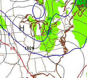
Anyway, the GFS tries to scrape southeastern Kentucky with a touch of snow. It then zips that storm to the northeast and shows a weak system producing some light snow for Thanksgiving Day…
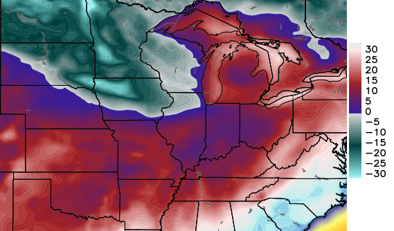
 The Canadian Model says that system doesn’t arrive until Friday and unleashes another surge of arctic temps. Check out the Friday night lows from that model…
The European Model brings the same arctic front in here Friday with some flakes along for the ride.
Per my winter forecast, this pattern should relax some in the early part of December. That’s simply a reload of what is likely to turn into another prolonged, harsh period of winter from the second half of December into January.
I will have updates later today. Take care.

Wind advisory?
Wow Chris. Looks like we are in for a little bit of everything I the next few days. With wind that strong will we have more of a chance for seeing anything even remotely severe as this thing ramps up and across Kentucky? Just wondering. Thanks for keeping us alert, as usual. You are the best! Have a great Sunday everyone .
Wednesday system continues to creep west on most models..Need it to wind up tighter than a banjo string..Would definitely shift west..But of course when Eastern Ky need’s a shift it just get’s the shaft..Today’s run of the Euro should be interesting..Hope the trend continues..