Good Saturday evening, gang. I wasn’t planning to update until I got a look at the late day model runs for later this month.
I’ve been pointing toward Christmas week as our transition week into a harsh winter pattern. That transition looks to be the coming week instead with Christmas week into New Year’s week taking on more of the harsh look.
The GFS Ensembles for Christmas week…
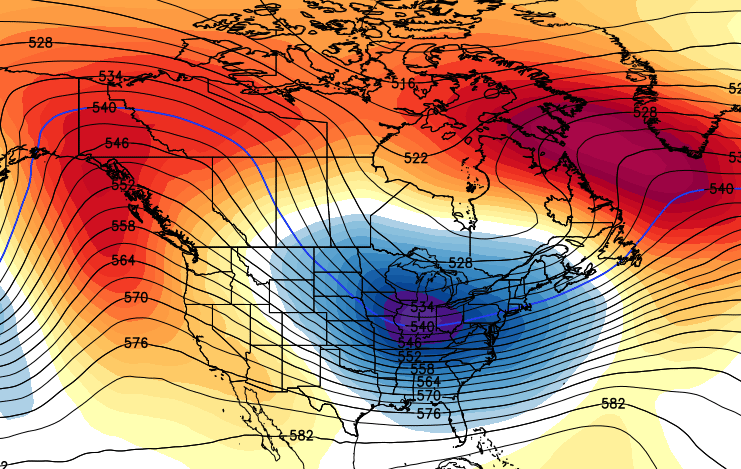
The control run of the Ensembles has a brutal look to it…
Notice the tremendous amount of blocking along the west coast and across northern Canada. That’s the look some of the historic winter’s from the past have given us. Now, I’m not saying this is a historic winter… but that’s pretty awesome to see if you like cold and snow.
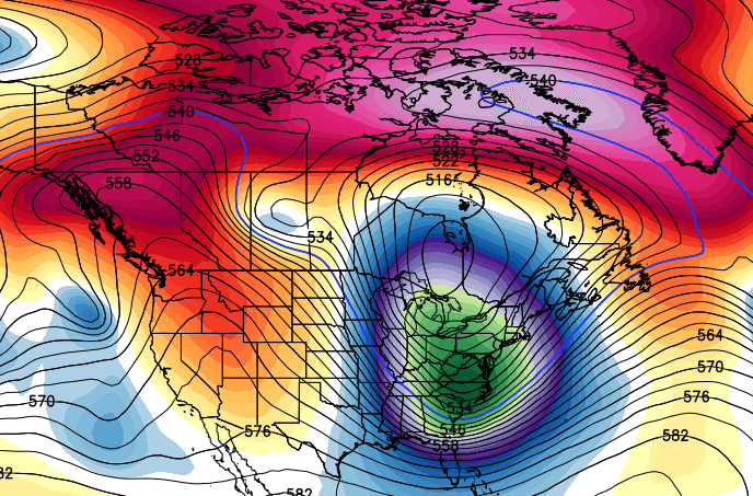
The GFS actually matches what the Ensembles show in the extended period (doesn’t mean it’s right). Check out the lows a few days after Christmas…
Interesting times ahead!
I will have a full update later tonight. Make it a good one and take care.

Thanks for the update Chris! Is it New Years week that your now thinking the cold and winter weather will hit Ky?
I think 89 or 90 was our last cold and snow Christmas & New years.
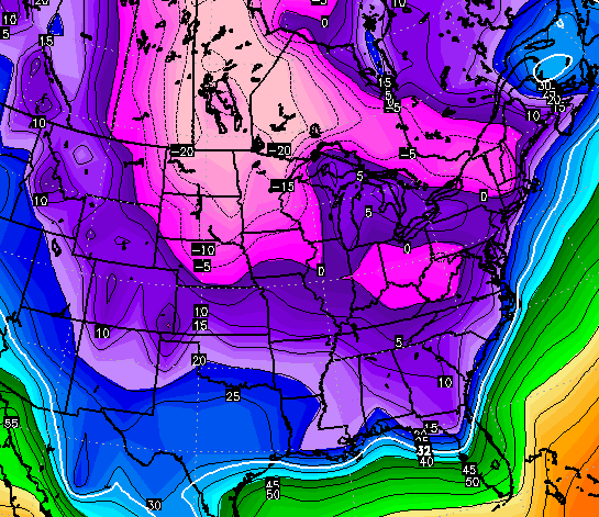
The models are even suggesting a few rumbles of thunder could be possible in most of KY/TN early next week before the cold front arrives. But severe t-storms are not expected, at least at this time.
Oh, congrats WKU mens basketball on getting a win against Ole Miss 🙂 . A road win in Oxford MS at that 😛 .
If those maps do not include snow then no thanks….
No mention of the possible southern Ky snow this weekend, lol? SMH, the models giveth and the models taketh away.
NWS in Louisville had a interesting forecast discussion about this upcoming weekend. The boys from NWS in Louisville are leaning towards the Euro and Canadian models as of now and are disregarding the GFS. (NWS at least in the Louisville office just not fans of the GFS as of late based on performance) There going and leaning to a colder solution with a much more wintry threat for Friday night into Saturday. NWS is thinking just about the same as CB maybe a tad bit more aggressive than CB. All depending on what transpires this week NWS believes the weekend event could be somewhat significant on the wintery side of things.
wait,,,,,,,wait for it,,,,, OLD SCHOOL COMITH!!!!!!!!!!!!!! Bailey hope to made it down see u today ringing bell, but family issues got in the way!!!!!!!