Good Monday afternoon. Rain is working across the state from west to east and this will usher in much colder air in the coming days. This will then lead us into a pattern that is LOADED with winter and the increasing potential for a rather harsh period.
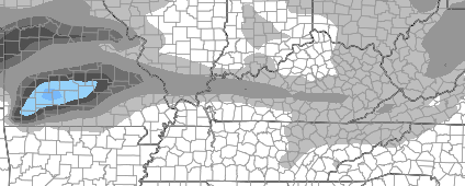
The action begins with a swath of light snow streaking into the region Wednesday night into Thursday. The best chance for this will be across the west and the southern parts of the state…
The air associated with that continues to show up colder on the American Models. Shocking, I know!! These models are solely responsible for the day after day blowtorch warm forecasts you have been seeing in other weather circles. Those started the week before Thanksgiving with many forecasting sun and 60 for that big day. It turned into one of the coldest Thanksgivings on record with snow. OK… fine… I’m stopping by rant before it gets started. 🙂
Back to the models and the weekend potential. The GFS is now the ONLY model that is 100% clueless. The “new” GFS is even finally sniffing something out…
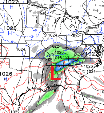
12 hours ago, the Canadian Model had no storm. Here what it looks like now…
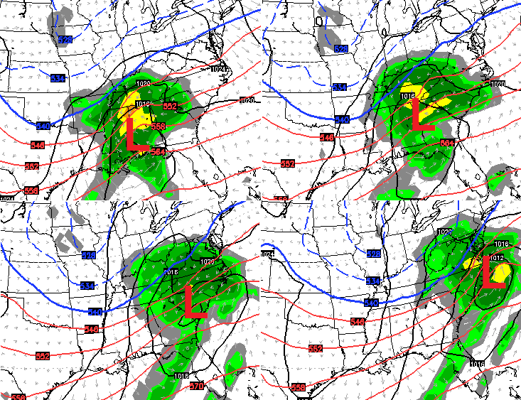
In my last post, I said it’s important not to latch on to any one model or solution and to look for trends. What trends are we seeing with the above models? They went from showing goofy solutions to showing something similar to what the European Model has been consistently showing for several days.
The European Model will be out soon and I will tweet some information with what it’s showing. As consistent as the model has been, it is due for a goofy run of its own, so we shall see.
The action won’t stop with this system… the Christmas week and New Year’s week are loaded with snow threats with arctic air joining the mix.
I will update later. Take care.

Any idea what time the Euro runs?
Chris just tweeted its a little farther South with a solid hit for Ky. Better to jog south a little than north ( if you like snow)
Thanks,Chris, for all the updates! I’m getting excited!!!! Fingers crossed here in SE KY!!
So the Canadian finally came to its senses. Let se if the U.S. models can do the same. Going to be fun to track. Thanks for the update CB.
Good to see the Euro hold serve and track a touch south instead of north
Of course by this time tomorrow the models will have highs in the upper 50’s for the weekend with heavy rain and the accumulating snows will be in northern Illinois j/k lol
Why no Rolo-coaster ride yet? 🙁
The snow for Wednesday night Thursday…accumulating any?
Probably not accumulating….
Nice day here in carrie of knott co. Sunny and temps pushing 60. I’d imagine the weekend storm will be another cold rain with a few back end flakes for seky just like all of last winter
here’s my logic: the weatherTrends have been with Kentucky over the past 15 years..the high gas trends have been there as well. It seems we have busted the gas prices trends so why not go ahead an let’s bust this Bubba 33/32 trend over past 15 years and bring on several snow storms over the next couple of weeks!!!
While we’re at it: Bengals bust this stupid “no show in primetime” trend and beat the Broncos next Monday night!!!
Gosh that would be amazing!!!!!
Such an alignment would cause a rift in the time continuum, Number One! Engage!
These aren’t the droids you are looking for Bubba. Lol
Henry at Accuweather thinks 12″ or more is possible this weekend.
You just cursed us.
hey BUBBA, well Euro came tad south, but still forcasting a OHIO RIVER County as far as SNOWSTORM goes.
Uncanny how 33/32 is a factor for us, so we shall see 🙂
If snow is on the way soon, then I’m glad I got out today and did some shopping. Rather go while we have temps in the 50’s than when it’s in the 30’s. Some snow would be nice….I’m hoping for some between now and Christmas. Chris says the Possibility is there and that is something to look forward to as we get closer to the big day. What would really be super is if the whole state got in on the snow. Yessss!
The afternoon Paducah discussion sure downplays this storm saying too much inconsistency in the models, too much warmth, etc, etc. Of course, they almost always lean to the GFS. Anxious to see Mr Bailey’s update. Roger in Dodger
It’s about choice I guess? ? Some look at potential and downplays it, some look at potential and ….well we snow lovers get excited (dumb and dumber. ..”so we have a chance”)
Just eyeballing the Euro from today it looked like the low was weaker and further south..Therefore less snow totals..The GFS is not worth mentioning..Guess Thursday we will know if this is gonna amount to anything..
Nothing to see here. Just another cold rain for us more than likely.
Roll Troll roll
I feel like it is looking a little better. I noticed that the weather channel website now has my area in rain to snow. There high has come way down on their forecast. Usually this happens about the time the model (or models) they use start coming around to what Bailey has been showing. Might not be snow but looking colder and colder for my area.
Really need to get my generator hookup ready. New furnace is not like the old one so I have to put in a place to plug it into the fuse panel. Would not like to see ice and would like it even less if I could not use my generator with my furnace.