Good Monday evening. Our big storm system is ready to blow across the bluegrass state as we get closer to Christmas. You will hear this system on top of us with winds really cranking up for Christmas Eve. Check out some of these gusts…

That will be accompanied by heavy rain and crashing temps from west to east. Readings will drop more than 20 degrees in just a few hours with some snow showers and flurries late Christmas Eve into Christmas Morning.
That system move and is replaced by a cold front swinging in to start the weekend. A storm system develops along that from late Saturday into Sunday…
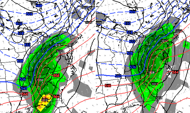
That’s followed by another storm system 2 days later…
Another system follows that up about a day or two later…
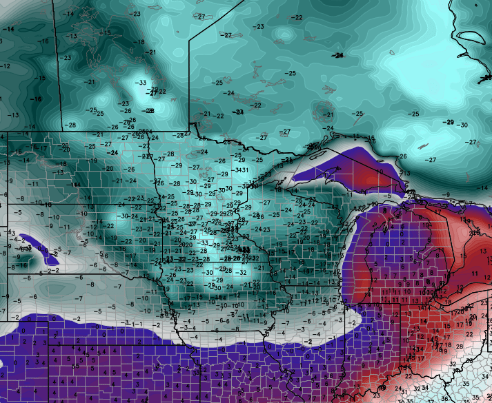
A stalled out front with waves of low pressure developing along it will provide us with a lot of rain, snow and mix chances this weekend into early next week. The above maps are from the European Model.
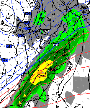
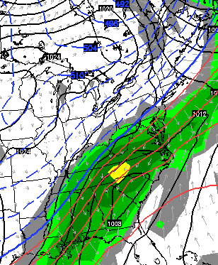
The Canadian Model is similar with the setup…
That’s some brutal air showing up behind that boundary. Check out the same run of the Canadian…
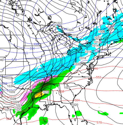
 This is a very busy pattern that is loaded with a lot of winter as we close out December and roll into January. As always, the devil is in the details with each system. The pattern itself is fairly easy to diagnose, though.
Enjoy the evening and take care.

Thanks CB!
Wonder if we get out of the 33/32 rut at some point? Most moisture tends to be adios by the time the freezing air settles in. Well, unless ice of course. Boo!
i just wish the weather was active its kinda boring.
Might just see all four precip types over the next week and a half. Rain/freezing rain/sleet/snow. Looks interesting to say the least. Hopefully the cold air works in quicker Wed. to the change over to snow.
I think we are back to our typical Winter pattern. Just an occasional little nuisance snow, inch or less. I hope I am wrong but I think this Winter is DOA. In my area there are no nighttime lows predicted below freezing for the next week. Highs mostly in the 40’s but near 70 for XMAS eve.
There are 3 full months of astronomical winter left. It literally began yesterday. Come on, you can’t give up that easily can you? Just think, last winter had 70s and a severe weather outbreak. And in my 7 years of living in Kentucky, rarely did I have snow days in December. The bigger storms were always after my birthday, which in mid January.
it looks busy alright …rain …rain …rain sitting on bubbas dreaded 32/33 fence
Some lightning strikes now showing up in the Land Between The Lakes area, in both Kentucky and Tennessee.
Southeast ridge is going to be a issue…need it to flatten out and hope a -nao develops at somepoint this winter. The setup showing will be good for north and west ohio, but eastern KY looks like back end snow…of course the models are probably wrong…lol
looks like lot of rain for southeastern part of state for next week or two. the 33/32 rule comes into play once more. lucy has the football ready,but i think ill stay inside in the dry.
sometime in jan , may be mid or late jan, we may get a clipper system that brings a couple inches snow. clipper systems is best shot of seeing any snowfall this winter. all the southern feed storms has too much w.a.a. .
w.a.a. warm air aloft. it always wins . i used to say that about every system that comes though. usually i was right.
I would have liked to hear more about this wonderful warm weather we are having and will continue to have the next couple of days.
That we weren’t supposed to have?
Meant to say that we weren’t supposed to have 7 days ago?
11pm…on December 22nd…normal high is 42…currently 53…at 11 freaking pm. Likely 20+ degrees above normal for the high tomorrow. Naw, no warmth here.
It’s pretty awesome! Already craving Spring. . After wiping delusional fantasies of snow from my thoughts I’m actually hoping Bryant’s trolling blowtorch theory somehow rings true.
Yikes….the dreaded cold rains. I still have not given up on the abundance of winter!
I guess a lot of the mets that were saying blowtorch weren’t as dumb or stupid as some on here were saying ….I guess they get the last laugh on this “cousin” storm … I know they will say I told ya so…I just wish someone would admit when they r wrong …will never happen
Bengals going to win!!!!!!!!
Who Dey