Merry Christmas Eve! Today has been one wicked weather day across Kentucky with crashing temps and high winds. The highest gust of the day was 61mph in Lewis County! Wow. Some wind damage and power outages have been reported across central and eastern Kentucky.
The colder air continues to pour in with the potential for some snow flurries or snow showers tonight into Christmas Morning.

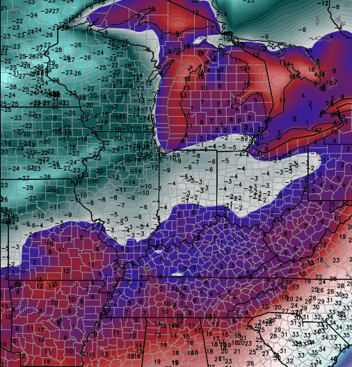
Current temperatures

The weather pattern after this continues to run on the active side as arctic air FINALLY returns to the country. It’s been absent since spending most of November in our part of the world. I admit… it’s been slower to return than I thought.
The return of arctic air into the United States will then combine with a very active southern branch of the jet stream. That will lead to a lot of winter in the coming weeks. We get one system to move in here this weekend with rain Saturday into Sunday. That system may end as snow Sunday night or Monday via the Canadian Model…
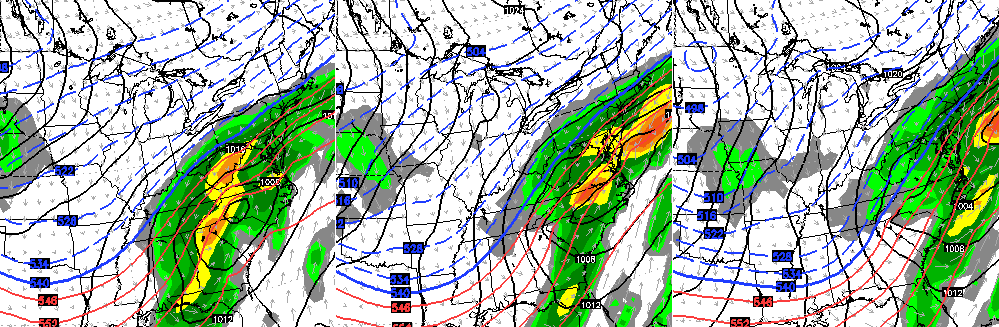
That same model then goes crazy with the cold to start 2015…
Other models do not bring that type of cold in here that quickly. Instead, they keep a stalled out across the region and continue to spit out storm systems along it. That’s really what you want to see if you want a snowfall. Every model delivers a snowfall to our region next week, but they differ on the day it happens.
The new version of the GFS says Happy New Year…
The pattern next week into the first few days of January is ripe for accumulating snows around here. That’s the first time I’ve written that this season! 😉
Merry Christmas and take care.

Merry Christmas Chris and all who read this blog
Ditto! Merry Christmas all.
I hope the Canadian Model is right and pushes the cold straight through. I think that should happen given the projected -EPO.
No nw trend. Saw enough rain for while. Ready for snow.
Merry christmas everyone
Merry Christmas one and all! Maybe Santa will put some snow in our stockings for the coming year.
Merry Christmas! 🙂
Merry Christmas everyone!!!!!
Wishing everyone here a very merry Christmas. If you are out and about stay safe.
He said…’ripe’! I say over ripe…and do not want to see rotten….because as Mike, BubbaG, Rolo and the rest of us just south of the KYRiver barrier know…we have had our hare and then some of rotten! The only thing I want/need this Christmas and into 2015 is snow to verify..a big one …at least once!!!! And I have been a very goood girl…..
Agreed as we have the same issue here in The Ville just south of the river. Mwerry Christmas…..
Think Snow!
Merry Christmas, everyone! 🙂
Merry Christmas fellow weather junkies and snow lovers! A special Merry Christmas to CB and family. Thanks for your time and dedication to the blog. Hope you have a peaceful holiday!
My hope for all is a healthy and happy New Year and don’t forget the one who gave us the gift of a lifetime (eternal life) Merry Christmas all
Everyone stay safe, stay warm, and look out for those around you when they don’t seem to be doing it for themselves.
Merry Christmas to all and to all a metric @#$* ton of snow we all hope to be shoveling next month. 🙂
Hoping everyone has a safe and joyous Christmas. Thanks to Chris for his countless hours producing this blog and to everyone else for your own personal insight. What a great bunch of opinionated peeps….me included! haha Looking forward to what the new year has to hold.
Merry Christmas to ALL….May we be begging for relief from all the Heavy Snow in a month 😀 !!!!
Merry Christmas to all. May all the young ones wake up to a very joyous Christmas Morning. Thanks Chris for all your hard work and dedication in what you do. Peace!
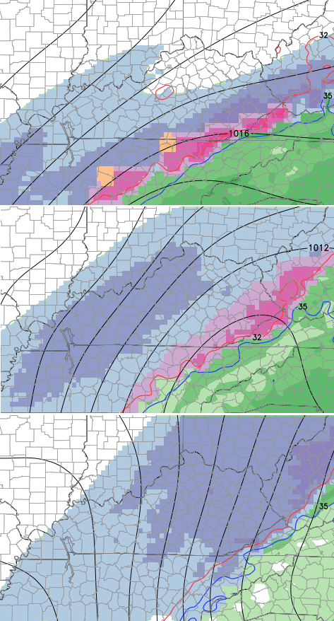
Lots of dark pink in TN and SE KY on those plots. Hopefully the northwest trend doesn’t kick in and bring that mess into central KY!