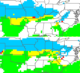
Good afternoon, gang. Our sideswipe snow put down hit and run accumulations across southeastern Kentucky last night and early this morning. Up to 5″ fell in areas along the Virginia border counties. The rest of our day will be dominated by some snow showers and flurries as arctic air filters back in.
Temps tonight will head back toward the single digits for some and we can expect something similar for Saturday morning. Highs Friday will be in the upper teens and low 20s on a day when 50ish is normal. Think about that one and give this weather the proper appreciation.
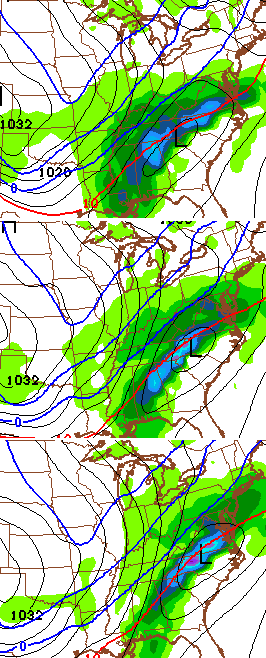
The busy pattern cranks back up Saturday night into Sunday morning as moisture returns from the west and southwest. A wintry mix will be possible during this time…
That sets the stage for a mix and rain from Sunday into Monday as the first system works eastward across the region.
The next low is going to try to work just to our west and north and deliver us a brief spike in temperatures for Tuesday and early Wednesday. Heavy rain, gusty winds and thunder will be possible during this time.
Winter quickly returns later Wednesday and Thursday as arctic air pushes back in from the north. There is some indication that another area of low pressure develops along this to our south and east…
That could make things rather interesting around here and into the Ohio Valley as our temps plummet.
Spring lovers (and that includes myself), look away…
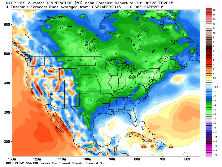
That’s the Weatherbell CFS temp departure between now and April 12. But, I thought true spring was supposed to arrive next week? Isn’t that what we’re being told? 😉
Have a great day and take care.

It looks like it still might be a while until I can fire up the grill. At any rate thanks CB for the update.
2-4 inches county wide in Leslie County overnight…CB nailed it again! we have received over 20 inches of snow here in Hyden over the last two-three weeks!
I`m hoping BG can get another good snow before spring. Sorry #Spring.
WKYT weather page states 48 as the “normal” high for today.
CB, does the WKYT use of “normal” come from mean, median, or mode in regards to historical temp data?
Having a 4 degree range would be an interesting twist on “normal”, as in modal plot show more days on the date fell between 44 to 48 degrees than any other 4 degree range.
Oh, and Berea received about a 1/4″ of additional snow from the 1~2″ event last night, which is a great match with my desire to shovel any more snow (i.e. zero). Others who would like more, I hope you received it out of that event.
“Normal” temperature of 48 is the same thing as the average high for Lexington. It is the mean of all the high temps on this date for the past 30 years, which is how the National Climatic Data Center (NCDC) keeps records for average temps. They use the years from each decade and create a sort of “new” normal temp for the next decade. For example, our average temps are from the period 80’s to the 00’s (I.e. 1980-2009)
Was starting to enjoy the site this year and now the pettiness is becoming unbearable.
I am starting to agree with you.
Thanks Chris. You are easily the best.
Not looking forward to the flooding the will happen when the rain and warmer weather hits. Then if those later week temps pan that will just be extra awesome. Cannot wait.
And I am guessing we should see some real fun storms with a mix of everything. I just hope we see none of that BubbaG (<– Ice, not the actual comments poster)
Not sure who everyone is talking about when saying “true spring is here, isn’t that what we are being told?”. I watch several meteorologists in Louisville, and I’m pretty sure none of them have said spring is here.
I havn’t looked at data, but based on memory (which I will admit, can and probably is flawed) I would think normal highs now are around 40 or 45. Average highs are likely based on many years of temps in particular days. This allows the higher temps from some years to push the number higher.
I hate winter, and am ready to see warm weather…so next weeks current forecast makes me happy…:)
It would be nice to look at a full data set instead of only an average I think.
Took winter forever to get here and now it won’t leave. Three years running of cold weather in March.
Hope the cold air can get fully entrenched before that last system blow through here. Really hope It moves in before the second one. What the heck I really really hope it starts as snow Sat/Sun and never warm up during the week. WAA had its play last weekend. Now it is the Artic air that needs to over perform.
Just trying to be optimistic for the snow lovers out there.
Think Snow! I will let everyone kow what the weather is like In Wisconsin. Heading out today and return Sunday night. At least I am used to the cold weather.
What’s that low pressure thing mean? Don’t sound good. I ain’t ready to start mowing yet but I also don’t like them cold temperatures. Old lady is grumpy and ain’t shaved her legs in a week. Bring on shorty shorts season.
I am trying to remain calm but I really like the sound of mid-week next week. I am with you Bjenks, I wouldn’t mind the weekend artic air staying in place. Bring on the SNOW!!!! (Sorry not snow lovers. It is 90 in South Florida today, may want to consider a vacation!)
The locals in WV are predicting the warm up and early Spring arrival next week.
Wow, seeing some forecasts with 60’s next Tuesday and 50’s Wednesday next week. Then showing ice for Thursday.
Not sure why school was out the last few. Warmer temps had made roads clear here everywhere I went. And I am guessing there will be school tomorrow even with the snow we had last night. Crazy to miss a whole week except go back on Friday.
I was reading the news where a couple eastern KY area schools have had more snow days than actual school school days. Some of them were losing their spring break.
What snow fell here last night has melted back to brown ground again. Prob 2-3 inches of snow left from snow pack where sun don’t hit. Temps are pretty fair near 40 again here in knott co with sunshine.
Sun doing a number on the snow today. Startng to see some ground. Snow will be a memory very soon.
We have broken 40 here, it feels like 80
Hey folks, when you give snowfall or temperature please tell us where “here” is. I live in SE Lexington so when I post snow or other conditions I try to remember to put seLex. Really helps us regular readers get a sense for what’s happening around the state and region ’cause I know what it’s doing “here.” : )
NWS in Jackson calling for widespread river flooding across Eastern KY next week. Your thoughts, Chris? The Levisa Fork of the Big Sandy is right behind my house!
It’s behind mine too well you can look out and see it there is a bottom between us. I share your concern.
Chris using that Ugly work, which we all know means cold rain coming by the the end of the weekend, oh well it’s been a great ride snow lovers, spring sounds great!
Temps going to spike to the 40s by Monday with rain then spike to 60 on Wednesday. Then temps will take a nose dive by Thursday with possibly snow maker by next Friday that’s what my local weatherman are saying here at western, ky
Snowing in Versailles!
It`s flurrying in Bowling Green.