Good Monday to one and all. If you’re a fan of springtime temps, you are loving the weather life we have for you out there today. Temps will surge into the 70s with skies remaining partly sunny. Not to spoil the spring party, but surges of below normal temps are set to return. Yippee!
Winds will be rather gusty out there today as some clouds increase later in the day. The big news will be the warmest numbers many of us have had since October… the 70s.

A cold front will slip through the region on Tuesday and could spawn isolated showers or sprinkles. Temps will start in the upper 50s and then drop into the upper 40s by the end of the day.
Wednesday is windy and chilly with temps in the high 40s for many.
A stronger cold front will then dive in here on Thursday as a wave of low pressure develops along it just to our south. That should mean a nice surge of chilly showers…
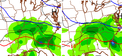
That’s a little ugly and the GFS has it just ugly enough to create some… wait for it… wait for it… snowflakes! Check it out…
I’m not sold on that idea, but it does have some merit. Either way, it’s part of the overall chillier theme the long range models have been hinting at for a long time.
After a spike in temps to start the weekend, another round of rain will likely introduce a colder shot of air later this weekend or early next week. The GFS is showing much of the eastern half of the country solidly below normal…
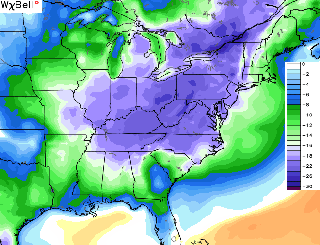 The overall setup still looks skewed colder than normal through early April. That doesn’t mean we can’t have some milder days thrown into the mix, but colder than normal should outdo the milder spells.
It’s also a setup that should deliver a lot more precipitation. Most areas are already experiencing on of the wettest Marches on record and we will only climb even higher on the top ten wettest lists. Muddy times continue!
As I said, enjoy the 70s and dry of today. Make it a great one and take care.

OK, now THIS seems more “Chris Bailey”-like. No in-depth technical model talk (not that I’m against it.) Also, his diction seems back to normal like using “wait for it… wait for it” and “that’s a little ugly…” Notice he used ugly and does not sound “excited” or very interested for the cool down as “he” did in the last post and the one’s before. At least that’s what seems different in this post than the last several one’s. Anyone else’s take on the conspiracy theories flying around about this past week’s posts? It seems I noticed it the first time in this post…
https://kyweathercenter.com/?p=13945#comments
And then it just kept going, until now, a Monday… Hmm…
Yep, just got the email notification, and read the post, then came here to comment to say pretty much the same thing, only to see that you already said it. XD
It still doesn’t seem the same. It’s like reading a post made by an app using Siri or Cortana. Today’s edition is just a response to being called out completely yesterday so someone thought they’d better up their game a little.
The time away would have been a nice opportunity for some of the more meteorologically inclined posters on here to get a chance to guest write a day’s post. It would have been fun to see some of you post your own styles even if the weather is pretty boring to work with right now.
I have absolutely no idea why Bailey would pull an unannounced stunt like this because it seems really out of character for him. How hard is it to say, “see yah when I get back”?
Those are exactly my thoughts also when I first read this post, just forgot to mention it. It still doesn’t sound just like him, but it’s still a lot more awfully close.
Yes this does look more like what we’re used to seeing.
Maybe he didn’t want the site to go down for days while he went on vacation. I gather the site would probably be even more up in arms over no posts than having someone else help compose them.
Today..
Smiley face.
From what I researched, and I may be wrong about this, but I could not find any information about the potential for mudslides and/or landslides for the higher terrain of Eastern Kentucky from the Jackson NWS office.
Hazard in Perry County absolutely got smacked with mudslides and slips that damaged or blocked area roadways.
Some NWS offices have specific landslide and mudslide advisories/warnings but at least mention it in the Hazardous Weather Outlooks or Area Forecast Discussions.
Again, maybe it was mentioned, and if so, my bad.
Spring is in the air in the air BG today. Sixties and climbin!
Could it hit 80 in west Ky. today?