Good Monday, everyone. We’re getting ready to say goodbye to March and hello to April in a few days. The road to April has been a very cold and wintry one, but we’re taking a detour onto a road that finally looks more like spring. I am MORE than ready for this journey! 🙂
Our day is starting with a band of showers exiting out of eastern Kentucky. Skies will become partly sunny with a milder breeze kicking in during the afternoon. Highs should reach the low 50s in the east and near 60 in the far west.


Tuesday’s weather looks much, much better with sunny skies and temps making a run at 70 degrees in some areas. That’s perfection for all the kiddos on spring break.
Wednesday will be similar, though there is some indication the north and east could be a little cooler with some more clouds.
Scattered showers and thunderstorms will develop on Thursday ahead of a bigger system rolling in to start the Easter Weekend. The latest models are speeding up and lessening the magnitude of the weekend system. Many of the models bring this through here on Friday with widespread showers and thunderstorms…

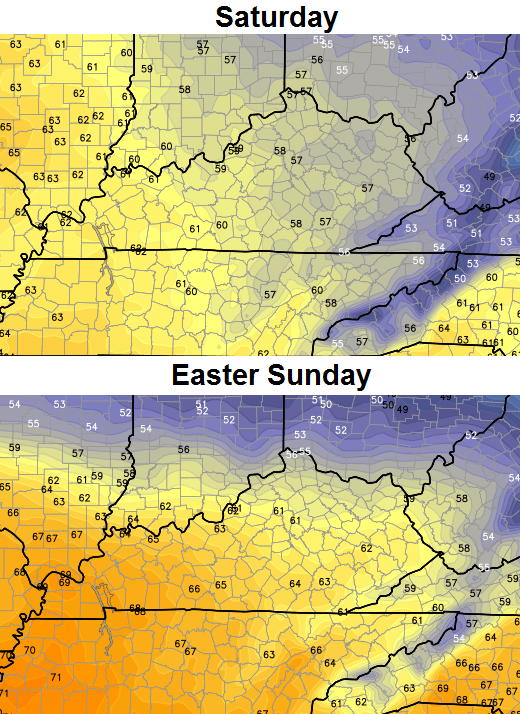
With a weaker and faster moving storm… the air behind that doesn’t show up as cold for Saturday and Sunday…
That would likely be followed by a MAJOR surge of warm air for the following week. It’s also a week that could see rounds of thunderstorms developing around here.
Make it a great Monday and take care.

Getting happier by the day
I like the part at the end. 😉
Good to hear less cold for Easter weekend. Earlier model runs looked pretty chilly. I’m visiting my family in KY from Wed-Sun, and glad no more cold blasts are coming down!
Not to jinx us, but I thought we would be a lock for some rough spring storms this year. Thankfully maybe not. Fingers crossed.
We still have a couple more months of severe weather season, plenty of time for severe weather. Now, all we have to do is wait and see if this tornado drought will break this year. (Hopefully not)
I am so ready for 80° weather and scattered thunderstorm season!
Glad Sunday is not showing up as cold. And I agree with Israel.
Which comment?