Good evening, gang. Rounds of showers and thunderstorms are on the way to the bluegrass state over the next couple of days. Some of these storms could be strong or severe and put down enough rains to cause some local high water issues.
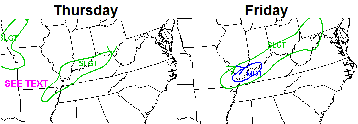
The Storm Prediction Center has parts of the region in a slight risk for Thursday…

That risk area expands to include much of the state for Friday…

Rainfall amounts of 1″-3″ could be common through Friday night. The Weather Prediction Center is hitting the high water threat…
This is the system we first started talking about last week and it has the potential to produce our first round of severe weather.
I’ve already been beating the drum about the potential for severe weather next week and I continue to do so. It’s a strong signal showing up from the plains into our region.
Enjoy the evening and take care.

Thanks Chris!
That Marginal Risk product the SPC has developed isn’t doing anything for me whatsoever.
It’ll be somewhat interesting to see what happens next week. There have been a few times in the past where harsh snow and cold have been followed a few week laters by harsh severe weather I guess because the overall pattern has still been juiced up.