Good Saturday to one and all. We have some absolutely gorgeous weather across the bluegrass state for the next couple of days. This break in the stormy weather will have a short life span as storms return by Monday. Nothing has really changed with the overall pattern… it’s very stormy and very wet.
High temps today will hit the low and mid 60s for most areas with a partly sunny sky. Temps on Sunday look even better with 70s across the board. Some clouds will filter in later in the day and those clouds will eventually spit out thunderstorms for Monday…
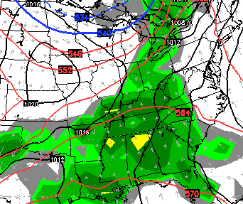
This action is looking to be a little more widespread and a little more on the heavy side.
Another surge of showers and storms would then follow that up late Tuesday into Wednesday…
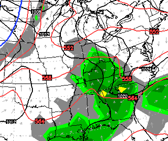
The late week setup continues to look very active with a slow-moving storm system rolling our way. This could bring additional rounds of some big boomers and more heavy rain…
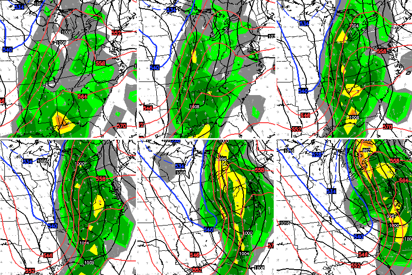
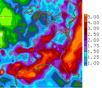
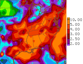
The rainfall numbers for next week from the GFS…
Let’s expand that out to the next two weeks…
 There’s a lot of ugly ahead of us with heavy rain and storms. We may also get some chilly shots of air to join the mix through the rest of the month and into early May. Green thumbs, don’t get too overzealous. 😉
Have a good day and take care.

Ugh. Don’t mind some rain but I would prefer that we got the pattern reversed…a couple days of rain and then several dry ones in a row instead of the opposite. Oh well hope this doesn’t mean a dry summer ahead. Thank you Chris for the update, and for all you do. Have a great Saturday everyone and enjoy this gorgeous weather!
Nice day outside although the breeze is still just a bit chilly. The forecast is nothing too unusual for April except the excessive amounts of rain we have seen so far. No matter what happens, I make the best of it. 🙂
It will be interesting if this trend in some fashion continues through summer as well.
Chilly this morning, but going from about 40 a few hours ago to 69 now in Nashville. Enjoy 😛 .
Further confirmation that the long-track tornado in northern Illinois was an EF4:
http://weather.gov/lot/15apr09