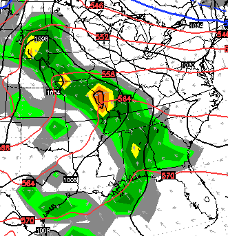
Good Thursday, folks. It’s another day to keep the umbrellas handy as scattered showers and thunderstorms work across the bluegrass state. This action could put down some locally heavy downpours before we catch a small break in the action later Friday into early Saturday. Notice I say a small break.
Some areas could pick up a half to one inch, but many areas should stay well under that. Still, keep a close eye on creeks and streams since our ground is so soggy.
Friday should see temps surge into the 70s on a gusty southwesterly wind. Only an isolated shower or storm chance looks to be around during this time. That warm air hangs tough into Saturday as late day showers and storms increase from the southwest…
That would be followed up additional rounds of showers and storms swinging through here on Sunday…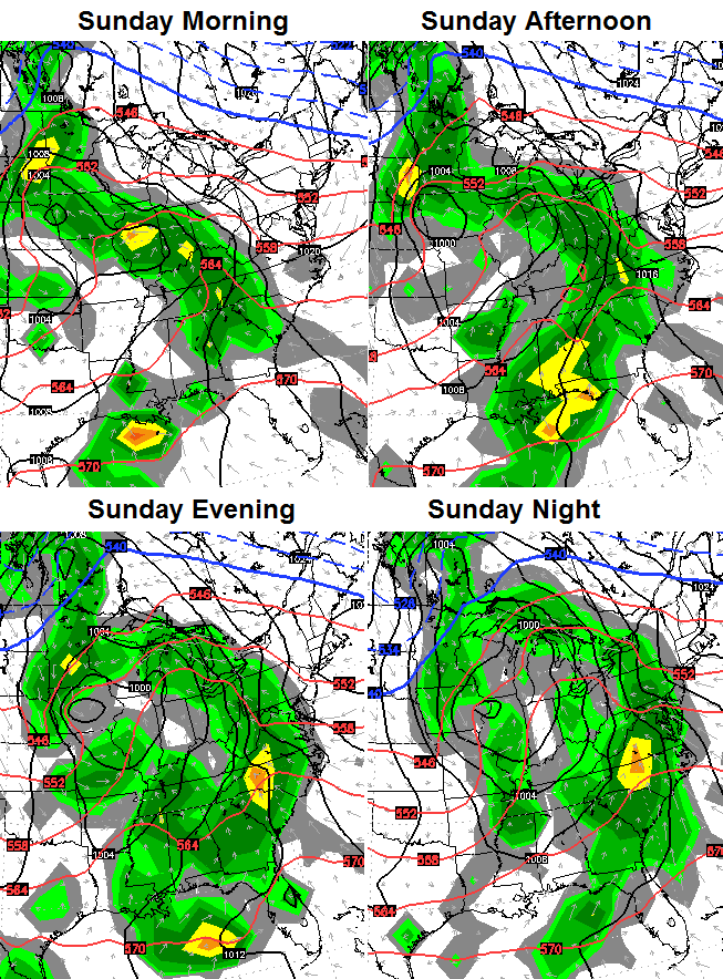
Much of the region should be able to pick up another inch or two, at least, of rain through Sunday night. We will continue to watch for high water problems during this time.
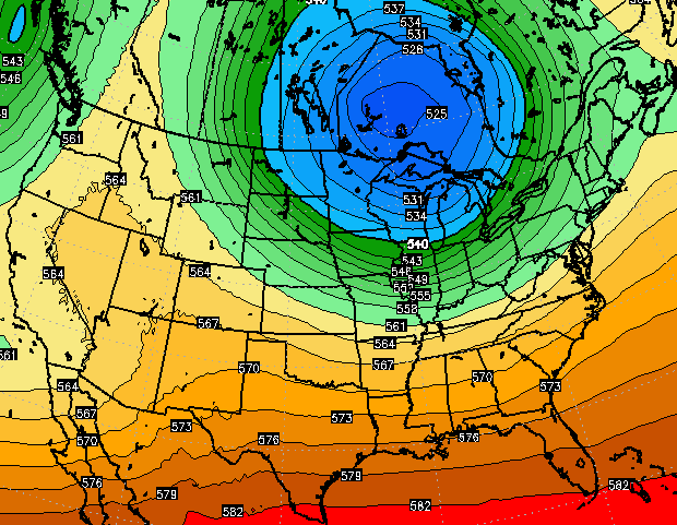
The pattern may dry out and cool down for the first half of next week…
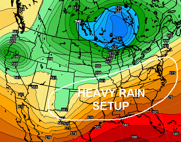
That’s would be a welcomed site if it materializes. The problem may come later in the week as that big upper level low gets pushed back to the north just a bit as warm air develops across the southeast. That could put our region back into a heavy rain zone…
I leave you with your tracking toys…


Make it a great day and take care.

Thanks Chris. Please turn off the spigot for a few days!
It was on this day in 1998 that a severe wx outbreak hit, including several fatal tornadoes in Kentucky and Tennessee.
http://www.crh.noaa.gov/Image/lmk/pdf/April_16_1998_Poster.pdf
http://en.wikipedia.org/wiki/1998_Nashville_tornado_outbreak
This event included Bowling Green’s infamous hail storm, Nashville’s downtown tornado and the so-called “Forgotten F5” twister in south-central Tennessee. There was also a tornado near Cleveland TN that struck a very short distance from my family and I during my teen years; it was kind of a shock when I heard there was a fatality involved. This outbreak further spiked my interest in weather.
I later attended WKU during the 2000s and there were still a fair number of “hail cars” on the road in Bowling Green 😉 .
CB ain’t feeling the rain, cant say I really blame him its just a touch excessive to say the least.
HS baseball and softball teams are suffering. Please turn off the water for a few days!!!!
Oh my goodness. I got caught in the downpour today. I left home to a really nice day and came out of the grocery store to a storm. Shew! I’ll be so happy when we see some nice sunny warm days. Thank you for all you do for us Chris. I just found out the hard way today to check your weather forecast and maps before venturing into town. 🙂