Good Saturday, everyone. Today is shaping up to be a very nice weather day across the bluegrass state with some sun and warm temperatures. The focus of the forecast is on the potential for severe storms and heavy rains returning for Sunday.
The setup for tomorrow finds a big dip in the jet stream working in from the west…
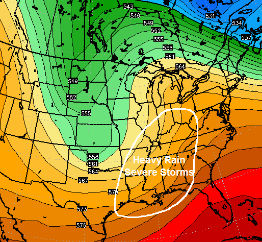 I’ve highlighted a large area most at risk for heavy rain and severe storms. That extends from the deep south into the Ohio Valley.
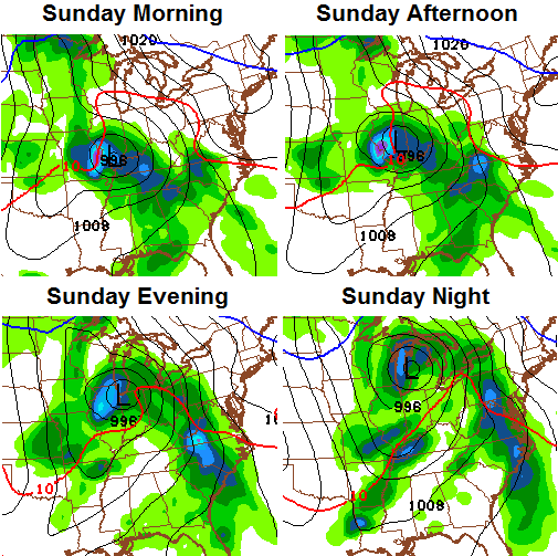
It appears we get one wave of strong storms and heavy rain to swing in from the southwest late Saturday night into Sunday morning. That would then be followed by additional storms developing later in the day. Those could be the ones to really ramp up on us. The NAM shows what I’m talking about…
 Showers and storms would then continue into Monday as a strong cold front moves through here. Temps behind that front will tank with highs by Tuesday only topping out around 60 degrees. Some upper 30s will be possible Tuesday and Wednesday if we can clean the skies up.
Additional rounds of showers and storms will likely fire up up late next week through the weekend. That’s a setup that could produce some strong storms and heavy rains.
Does any of that surprise you? Didn’t think so.
Make it a great day and take care.

Let the good times roll!
Mother Nature usually balances herself out at some point.. I bet we go into a drought this summer or fall..
Please tell me this is not going to be a high tornado threat???
At this time, destructive straight-line winds and large hail are the threats with the higher chances. Areas in and near Arkansas are especially in the crosshairs.
While an isolated twister or two can’t be ruled out with any thunderstorm, the tornado threat is forecast to be relatively low.