Good Tuesday, everyone. I’ve been hinting at a fast and furious flip to summer for early May, and here it is. Thermometers this week will reach normal levels for July. That’s impressive considering we were just talking about frost a few days ago. With the summertime temps comes an increase in humidity. Is it too early to be talking about muggy weather?
Highs today will reach the low 80s for most of the state. A few middle 80s will be possible across the west. Those middle 80s will be likely for much of the state Wednesday and Thursday. Upper 80s will be possible during this time.
This is when you will really begin to notice that increase in humidity levels and that could pawn isolated showers and storms.
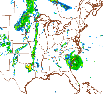
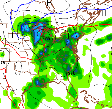
The overall setup has been well telegraphed for a while, now. A super warm pattern across the eastern half of the country with cool in the west and storms in between. There continues to be the chance of something tropical forming off the southeastern seaboard. The future radar from the NAM is impressed with that feature…
Whatever kind of system we have down there should meander around that region through the upcoming weekend. That keeps our region in a very warm and humid pattern…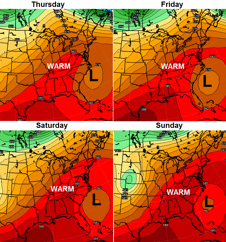
That’s a look that could give us a 90 degree temperature reading before all is said and done. The chance for a shower or storm will be with us through the weekend. Those chances really increase early next week with a strong cold front moving in…
Make it a great day and take care.

Thanks Chris. Looking pretty good today. Got the windows open and ceiling fans running and house is comfortable. Loving it! Have a great Tuesday everyone.
Well Covington finally hit 80 degrees yesterday for the first time in 2015. Looks like we will stay there for a while. Suits me just fine.
I love this weather! I have had the top down on the Jeep since Saturday.
Don’t look now but it’s starting to get dry. After being 2 weeks late getting our garden in because of all the rain we finally do and it hasn’t rained since. I was afraid of this.
Well that didn’t take long. Figure this was a good thing.
Please Chris, stop using the C word. It was 82 at my house today and all I want to hear is warm and hot. 🙂