Good Thursday to one and all. Steamy temps continue to grip the region and that’s a pattern that shows no signs of letting up through the upcoming weekend. Signs of a cooler change are showing up for next week, but I’m already focusing on another possible hot spell later in the month.
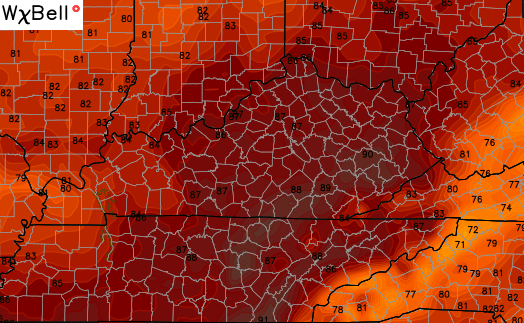
Highs today will hit the mid and upper 80s into much of the region. The increase in humidity will lead to a scattered shower or thunderstorm going up.


Friday looks a lot like today in terms of temperatures and the threat for a few storms.
If we can keep mostly sunny skies around on Saturday, temps may hit the 90 degree mark in a few locations. The GFS is spitting out a 90 in the east…
 Scattered showers and storms will increase later Sunday as a cold front across the plains states rolls our way. The exact timing of that front is still in question as we watch to see what kind of system develops off the southeastern coastline. As of now… the models bring this front into the state Monday…
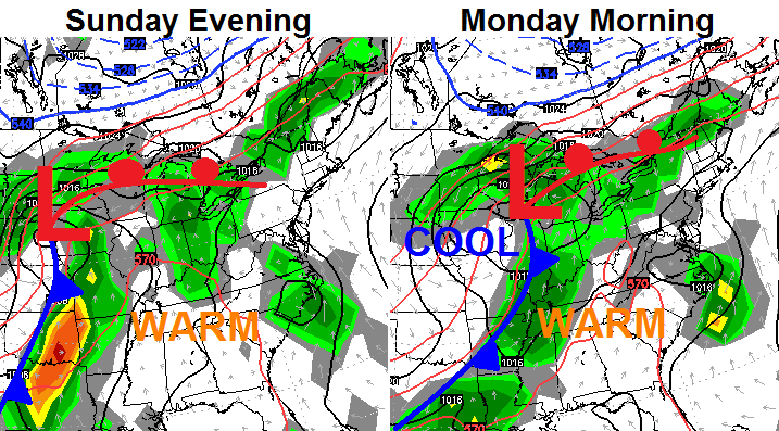
The numbers will come down behind that front with a day or two in the upper 60s and low 70s for highs. That doesn’t look to last very long with a possible significant heat ridge developing by the following weekend…
This type of setup will continue to drench areas to our west and north over the next couple of weeks…
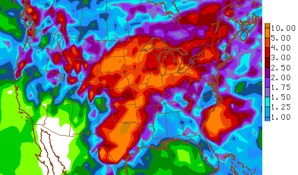 The more water we can put down across the plains, the less of a chance for serious heat developing as we head into the heat of summer. Right now… the plains are in line to get a ton of rain. This could be setting us up for a “more humid than hot” run of weather this summer.
Enjoy your day and take care.

Please tell me this is not going to be one of those LONG patterns that we get stuck in the entire summer.
That more humid than hot is not a great thing to me. I have no doubt it will be hot enough and that humidity will make it hard to cool down. Makes sense though with all the wet weather so far.
I was counting on CB’s prediction (a month or so ago) that it is going to be another cooler than normal summer for us. But I guess I’m jumping to conclusions since we’re not into summer yet.