Good Sunday, folks. It’s another day of tropical temps and scattered showers and storms across the bluegrass state of Kentucky. Our muggy run of weather has one more day left before we track some much cooler and drier changes into the week ahead.
Highs today will be back in the upper 70s to low 80s. Areas that try to sneak in a little more sunshine could reach the middle 80s. Once again, the sweat factor is going to be off the charts. Scattered showers and storms will rumble across the state with locally heavy downpours and a lot of lightning(LOL). There’s the chance for some late day strong or severe storms in the far west.
A strong cold front inches toward the state Monday with an increase in showers and storms…
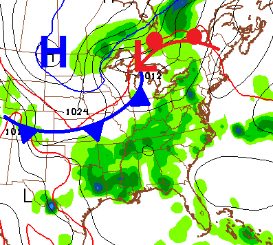
The severe threat for Monday is fairly low, but some isolated strong to severe action is possible. Watch for some heavy rain amounts and local high water issues with that setup.
The front will ease on through here Tuesday as cooler and drier air takes over. With a slower arriving front, Tuesday could still feature a scattered shower or thunderstorm.
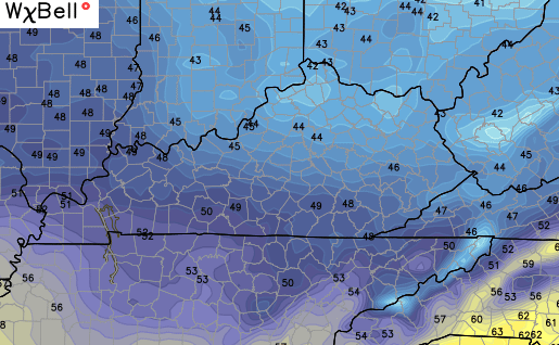
That cooler air then settles in for Wednesday with readings several degrees below normal…
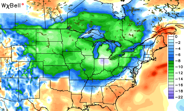
The GFS shows low 40s for some…
We will see a weak system weakening as it rolls in from the west. That may produce a shower or two by Thursday, but some clouds may end up being all we get.
Warmer air then moves back in for next weekend into the following week with the return of scattered showers and storms.
Speak of scattered stuff, let’s track…


Today’s risk area

I will have updates as needed. Have a great day and take care.

Had a great time yesterday where I got to meet the mets at the WKYT station and look behind the scenes. I’m proud to be a certified WKYT Weather Watcher and a NWS Storm Spotter!
I received an excessive 0.10 inches of rain near Harlan, KY this morning–that should help alleviate dry conditions (LOL)! We definitely need more rain down here in SE KY before our next extended dry spell comes…
We got a pretty good shower here yesterday, and it looks like we’re getting ready to get a bit of a storm or at least some heavy rain. Yep, it’s here! Good for napping! Ah well. Thanks Chris for all you do and now I feel a bit of a nap coming on …..zzzz the sound of rain on the roof mskes one ….zzzzzzzzz.