Good Wednesday, folks. A great brand of air continues to blow across the bluegrass state and this has a few days left in the tank. Changes begin to push in here for Memorial Day Weekend. Those changes will lead to an increase in temps, humidity and storm chances.
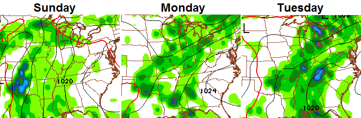
Speaking of storm chances, we have a window of opportunity for some scattered stuff late today into tonight. This fast-moving system will zip through here with a few showers and storms through tonight.

Leftover showers may linger into early Thursday. A mix of sun and clouds will take over with temps struggling to get out of the 60s for highs.. That should set the stage for another very chilly night. The GFS has some ch-ch-chilly readings by Friday morning…
Highs by Friday afternoon should hit 70-75 in most areas with full sunshine.
The Memorial Day Weekend starts with temps in the upper 70s and low 80s for Saturday with mostly sunny skies. The threat for storms will then increase on Sunday and Memorial Day. That trend should carry us past the holiday weekend…
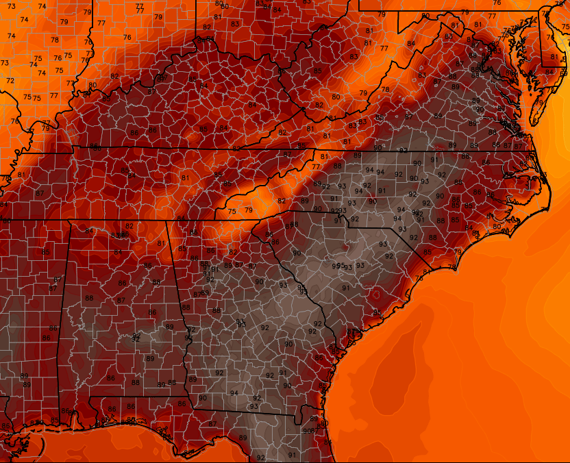
Memorial Day highs should reach well into the 80s across the bluegrass state. That same setup should bring some serious heat to our south and southeast…
 You may see that scenario play out a lot this summer! 😉
Have a great day and take care.

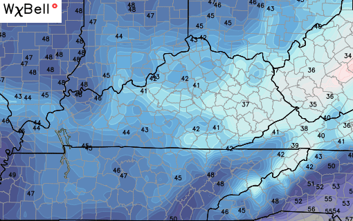
Thankfully, no one had to endure any 30s last night. I think there was one outlier of 42, everything else was mid-40s and above statewide.
Felt great out there on the morning walk!
Actually it might feel a bit more like early-mid October out there today and tomorrow. Not really my kind of weather…unless it’s winter…but who cares about that take.
Severe weather season appears to be over and done with though.
78 and perfect here in Williamsburg!