Good Tuesday, everyone. Steam and storms have been the theme of the past few weeks and continues to be the flavor of this week. The steam part is about to get kicked out of here in a big, big way. June looks to end how it started… cooler than normal, and that carries us into July.
In the short term, we have to be on guard for possible strong and severe storms today. A weak cold front is moving in from the northwest and will have a lot of tropical air to work with. That means any storm that goes up could produce damaging winds and produce a lot of rain and lightning. I will get to your tracking toys in a bit.
Wednesday may find slightly cooler and less humid conditions across the region… Especially central and east. A storm or two will still be possible.
Thursday into Thursday night could be very active across our part of the world. Temps Thursday afternoon could reach the low and mid 90s with the humidity levels making it feel much hotter. Winds will be very also be rather gusty. All of this may set the stage for rounds of thunderstorms to move in from the northwest. This setup can produce a derecho somewhere across the Ohio Valley. This period has my attention.
My attention is also focused on the potential for quite a bit of rain Friday into Saturday. A slow moving system will work right on top of the region with widespread showers and storms possible…
Heavy rain and thunderstorms could become widespread during that time. Another system pushes in from the northwest a few days later. The European rainfall numbers over the next week suggest the potential for some additional high water issues…
The Canadian Model ups the ante even more…
Those showers and storms are ahead of a winter looking dip in the jet stream that takes place this weekend into next week. Check out the view by Sunday…
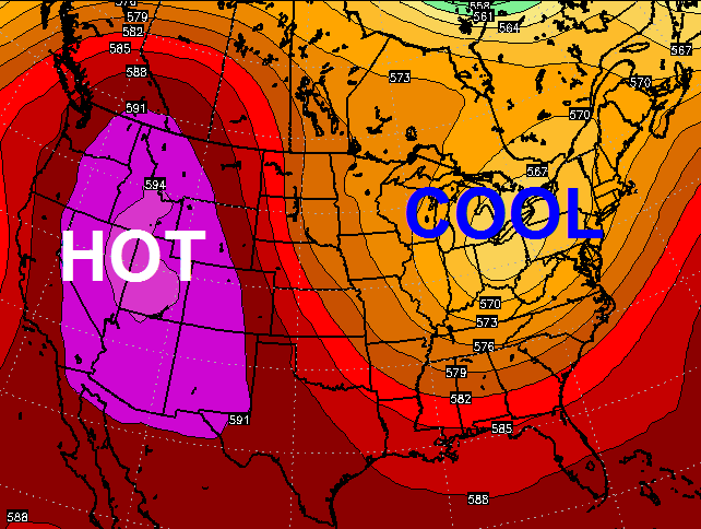 That trough continues to dig in as we roll through next week…
 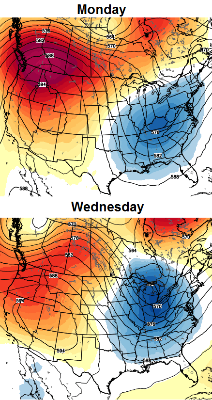 What does that mean for our actual weather? How about the possibility of several days in the 70s for highs and 50s for lows. A rainy day could even give some areas 60s for highs.
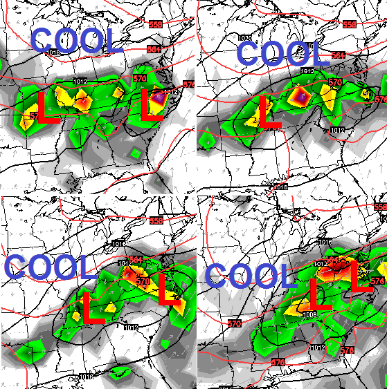
Let’s track today’s severe threat…


Today’s risk area

Current watches

Possible watch areas 
Make it a great day and take care.

Since I am camping right now, I really prefer that you not use the term “derecho.” Can’t we just keep “sunny and hot?” Keep the updates coming!
Whoa…Chris, for one, does not use the D-word lightly. I’ll be watching the weather Thursday even more closely now.
Also this is the one time of year I like to see maps with a big blue blob over the Eastern part of the U.S.
Good Times.
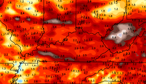
These dewpoints are just oppressive. Metcalf County showing a 80 degree dewpoint and most other reporting locations in the commonwealth are not far behind. Pretty much a given any storm that fires up today will have a insane amount of lightning.
Thanks Chris. If the Thursday system has your attention it certainly has mine! Will be watching closely to see what you have to say as it gets closer. Hope rveryone is having a great day!
Thank you Chris!
Thank you Chris. Appreciate the heads up for Thursday.