Good Saturday and Happy 4th of July. The biggest holiday of the summer is here and it looks like things won’t be as stormy as the past week. That doesn’t mean all is well in the wonderful world of weather, through. Some scattered showers and storms could still cause a few issues.
The greatest risk for scattered storms will be across the southern half of the state. This doesn’t look anything like what we went through last night, but a heavy downpour is certainly possible. Outside of any shower or storm… some sun could boost temps toward the low 80s.
The potential is there for a bit of an increase in scattered action later this evening into Sunday, and that could impact a few fireworks shows…
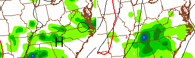 Again, today does not look like a washout.
Scattered storms with low and mid 80s will be around on Monday. Enjoy that relative “break” in the action. Here comes another cold front entering the picture by Tuesday…
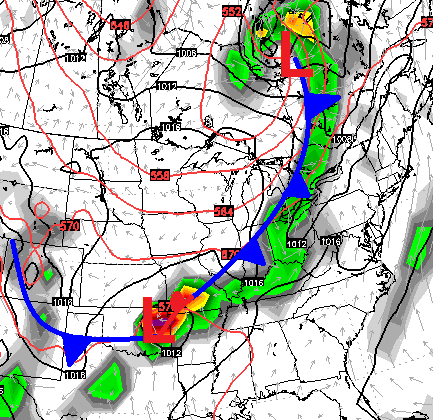
That will cause our rain chances to go up once again. Notice the wave of low pressure developing along the front to our southwest. Watch what the European Model does with that Wednesday and Thursday…
 That setup could bring more heavy rains back into the region. It’s a pattern that shows little sign of letting up over the next several weeks. This puts us on the path for the 3rd summer in a row with much above normal rainfall and little in the way of true heat. Wonder if that holds true for the fall and winter ahead? Hmm 😉
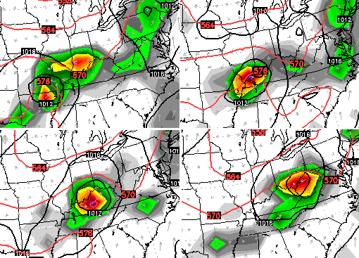
I leave you with your patriotic tracking toys…


Happy 4th of July and take care.

Happy 4th!!
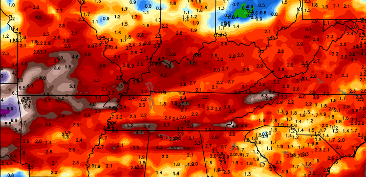
(but not for everyone http://imgur.com/SD2zApA )
I guess I must have missed the usual monthly recap on here about June. Over/unders vs. normal on June for precip and oh yeah, temps?
Everybody have a fun and safe holiday 🙂 .
A couple of EF0 twisters were recorded July 1 and July 2 near Nancy KY and not too far from Nashville (including Old Hickory TN):
http://www.weather.gov/jkl/20150701_nancytor
http://www.srh.noaa.gov/graphicast.php?site=ohx&gc=16
Thankfully, July tornadoes in our area tend to be few and relatively weak compared to the spring months. Indeed, neither Kentucky nor Tennessee have had any tornado fatalities during July, at least in recorded history.
Thanks Chris and Happy 4th of July to you and all my weather friends. I am hoping we get a little more independence from rain today as well! We managed to get a little over two more inches with yesterday’s precip. I would not mind seeing less today, and for a few days.
Want to wish everyone a safe and happy 4th! Enjoy the celebrations and fireworks but be safe!
Happy Fourth of July, Chris!
Just to say that it is 67F and bucketing it down here in Central West Virginia’s Lakes and Mountains, and, for the third year in a row, my pepper and tomato plants look miserable!
I think you are right about this summer-winter connection over the past few years.. interestingly, at the height of the Little Ice Age in the 16th century, torrential rains and crop failures caused the Pueblo Indians to abandon their agrarian lifestyle, move north and revert back to hunting bison..
Exciting weather week; have a great 4th everyone!
I drove through a good bit of central and north eastern Kentucky yesterday and I can certainly attest that everything is lush and green.
I would think even if this storm pattern relaxes for a bit the high temps will have a hard time given that fact.
time to fire up the grill and enjoy a coke and slice of apple pie. Happy 4th of July