Good Tuesday, everyone. Here we go again! Rounds of showers and thunderstorms are returning to the bluegrass state and these could bring additional heavy rains. The overall setup continues to be skewed toward much wetter than normal through the medium and longer range.
Scattered storms will be around early today, but that action will really ramp up this afternoon into tonight. That happens as a cold front moves in and puts the brakes on. The end result will be rounds of heavy rain producing showers and storms. A few strong storms will also be possible.
Impulses will ride eastward along this front over the next few days and bring more rounds of showers and storms…
Locally heavy rainfall will be possible during this time. Humidity levels will continue to run sky high with temps in the normal 80s.
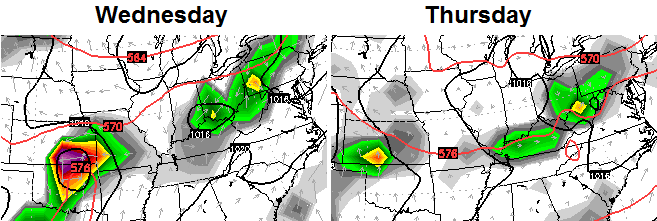
The worst of the steamy temps should come as we start the weekend. That’s when the sweat factor jumps off the charts for the entire region. A big dip in the jet stream moves in late weekend into early next week and that should set off some big storms… 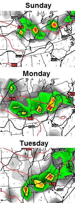 The models don’t handle rounds of storms very well, but they should be used to drive home the stormy point of the pattern. The latest rainfall estimated indicate we have to watch for more flooding over the next week…
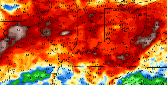
Your daily dose of storm trackers…


Today’s risk area

Current watches

Possible watch areas 
Make it a great day and take care.

Thanks Chris. Looking like the rain is getting close to Bowling Green already this morning. I sure am grateful for the lack of precip yesterday. Gave the neighborhood the chance to get lawns mowed. And I believe everybody in ours did just that! . Hope we don’t need to get a bushog to mow it next time! Have a great Tuesday everyone and stay dry!
I’m tired of this pattern.
Looks like we won’t have to wait until this afternoon after all. Bah.
Slamming on the brakes when you don’t have to…sounds like the cold front is just trying to fit in with all the other Lex drivers.
NWS Louisville following a strong ‘thunderstorm’ to the southwest of Louisville. I haven’t detected any lightning yet but heavy rain and strong winds are supposed to accompany the line.
0.63″ so far in Valley Station today. Rainfall amounts of 0.50″ to 1.00″ pretty common across Louisville today. More on the way.
MMKKK
the wind and rain that just came through northwest Lexington was NO JOKE….
News media in Louisville says suspected tornado damaged Heavenly Hill distillery in Bardstown. Other wind-related damage coming in from Anderson and Fayette Counties.
I’m just across the street from masterson station. That huge wind/rain did not last long, but it was scary. I’ve sort of wondered about the KLEX rain gauge as well. I wonder if wind blown rain doesn’t get measured accurately? Perhaps it just blew past the gauge?