Good Tuesday, everyone. Scattered showers and thunderstorms continue to push across the bluegrass state today, and those could cause some local high water issues. The cold front responsible for the storms is slowly working through the region. Unfortunately, that front looks to put the brakes on just to our south.
The storms ahead of this front will be on the scattered side with lots of breaks showing up. Locally heavy downpours will be possible.
That front then slowly slides into Tennessee and slams the brakes on for Wednesday and Thursday. This should slowly give us some better weather for Wednesday as skies turn partly sunny. There would still be the chance for a shower or storm in the far south and west, especially early.
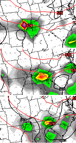
It’s looking more and more like a wave of low pressure develops along the front on Thursday. That could bring a renewed round of showers and storms to the region. Here’s the new European Model…
The best chance is across the south, but some action may make it into the Interstate 64 corridor.Heavy rains may continue to cause problems in these areas.
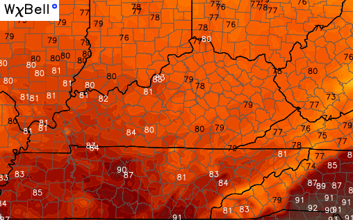
The good news comes in the temperature department. Cooler and less humid air moves in for Wednesday and Thursday. Check out the Wednesday highs on the NAM…
 That boundary will slowly lift back to the north by Friday and that means scattered storms return for the weekend. Temps head back to normal with another increase in humidity levels. That may be short lived as we a system or two drops in from the northwest.
I leave you with the tracking toys…

Current watches

Possible watch areas 


Have a great day and take care.

Thanks Chris! Maybe webcam get a chance to dry out from being so water logged. Three or four days would be a welcome relief to everyone who has been in the deluges of the past three weeks! But I will take whatever we can get! Have a great Tuesday everyone!
The air outside here in the northern part of Kentucky feels refreshing this evening. Hopefully that pushes south throughout the state with time.