Good Saturday, everyone. We have a typical summertime weekend ongoing across the bluegrass state. Very warm temps and a small chance of isolated storms will highlight the weather. All of that starts to change as we head into next week as storms increase, temps decrease and the tropics try to come to life.
Highs today will generally run in the mid and upper 80s across central and eastern Kentucky with a 90 in the west. There is a small threat for a popcorn shower or thunderstorm going up. Sunday will see similar temps with a better shot for a shower or storm cranking.
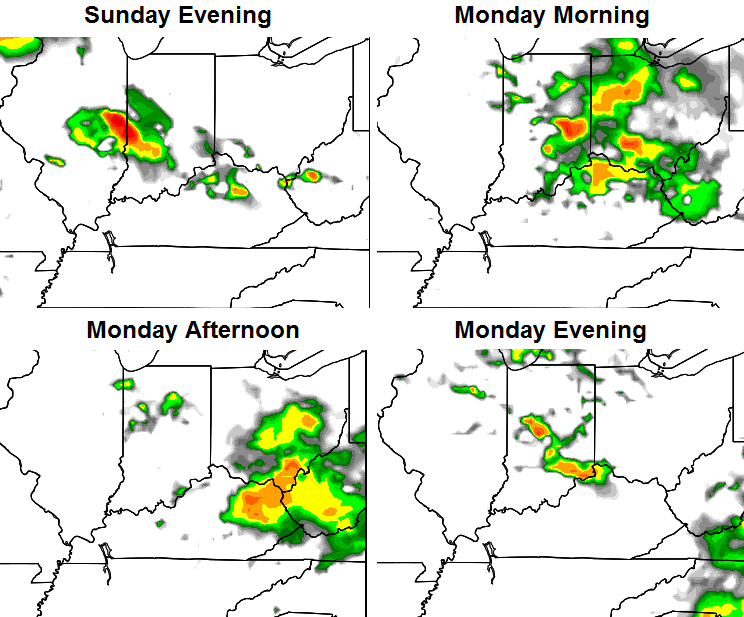
Those chances should increase a bit as we head into Sunday night and Monday as a system dives in from the northwest. Here’s the NAM simulated radar…
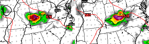
 The Canadian Model has some pretty good storm clusters…
 We need to keep a close eye on that setup as we do have the potential for some strong boomers that can put down very heavy rains.
Scattered storms will be around into Tuesday and Wednesday as temps climb to around 90 degrees. A cold front is forecast to dive in here toward the end of the week. It’s during this time we see several computer models indicating a potential tropical system developing off the southeast coast. The European is one of them…
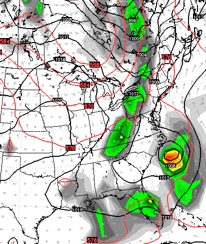
That’s interesting to see and will be fun to watch how the trough and potential tropical system interact with one another.
The development of a deepening trough continues to show up into the first week of August. That would mean some cooler than normal temps around here and across much of the country.
The GFS Ensembles are also indicating lowering heights across the Gulf of Mexico…
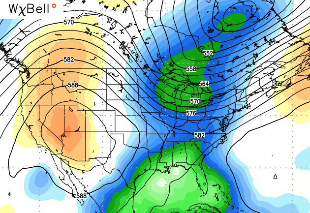 That could lead to some tropical mischief in the Gulf.
Make it a great Saturday and take care.

Hmmmmm…….very interesting….
Thanks Chris!!
I’ve been discombobulated all day since I didn’t have my kyweathercenter first thing this morning. Was kinda worried about our favorite weather dude for a bit. Now I can settle in…LOL
I actually wrote it like normal last night, but forget to hit the “post” button. Oops 🙂
Well Well Well – Me keeping my AC on 70F is showing in this months power bill. 158 dollars! Personally, I think it’s worth it!
I agree 175.00 summer bill and 250-275 winter bill all day long with me. It’s worth it to me.