Good Sunday, everyone. The final weekend of July is wrapping up with some typical summer temperatures across our part of the world. All of that is about to change as our weather pattern takes on more of a late September look and feel as we end the month and work into early August.
Highs today will be back into the mid and upper 80s for much of central and eastern Kentucky with a 90 in the west. A storm or two will develop as our flow aloft continues to come from the northwest. Throw in a weak disturbance moving in for Monday, and you get a better chance for some storm clusters…
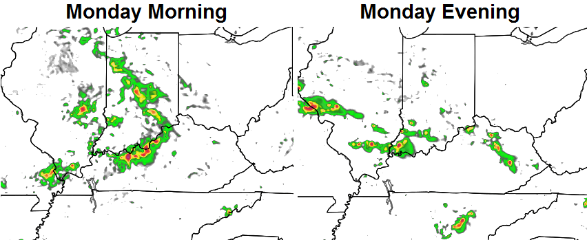
Temps on Monday will likely be, at least, a little cooler than today.
Isolated storms will again be possible on Tuesday as temps try to get to 90 degrees in some areas. The same can be said for Wednesday, but showers and storms will increase by the afternoon and evening. That’s in response to a strong cold front dropping in from the northwest. That ushers in a much better brand of air for the end of the week into the weekend…
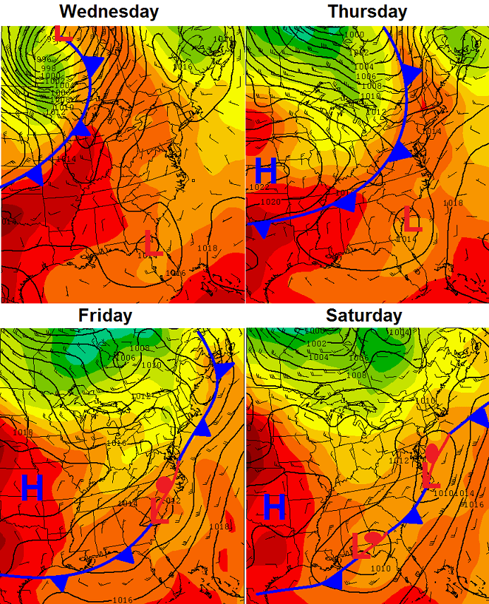
Notice the areas of low pressure trying to develop from the Gulf up the east coast. The models are trying to figure out if those are just regular lows or something tropical.
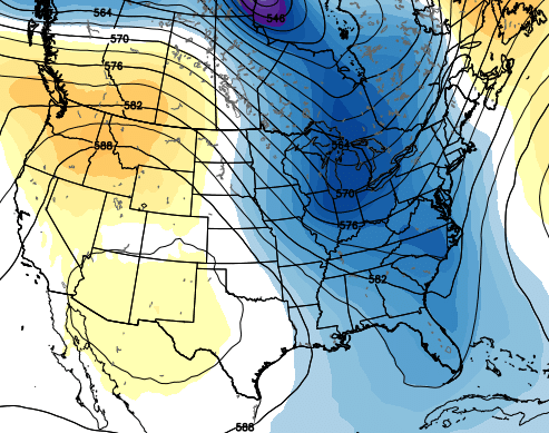
All of this is being fueled by a deep trough digging into the eastern half of the country…
I’m looking at that and wondering if we can get something to cut off across our region. That’s something to watch as we go forward.
I’ve been talking about how strong El Ninos (and we certainly have one) can produce some pretty hefty late summer and fall cool shots. The models continue to point toward the first half of August as featuring below normal readings. Here’s the CFS for the first few days of the month…
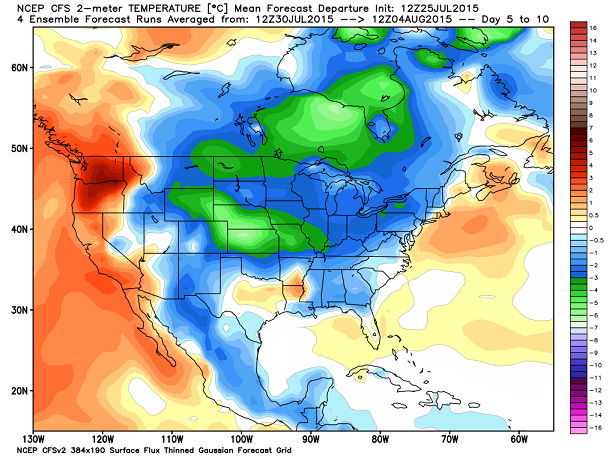
The following 10 days…
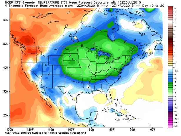
That’s cool… literally and figuratively.
Does that mean summer is over? No, but we really haven’t had much of one for the third straight year. In honing in on some of the fall analog years, don’t be surprised if we don’t pop a little hot stretch post Labor Day. 😉
For the past few months, I’ve told you how fascinated by the current strong El Nino that’s developing. The whole setup has no true analog and that will make for some fun forecasting times as we head closer to winter.
I leave you with your Sunday tracking toys…


Have a great day and take care.

Chris what does El Ninos mean for winters here in ky I have hear warm and dry is that right but I really don’t care as long as we don’t have a lot of winter thunderstorms and I don’t want 80 degrees on christmas that not to much to asked for is it…lol
You never have to worry about 80 on Christmas for sure. 🙂
It WAS 75 in February one year – I think 1976…..I remember THAT !
I think it was January of 2002 when we had 70s as well.
“All of that is about to change as our weather pattern takes on more of a late September look and feel as we end the month and work into early August.”
I imagine the pool owners who post here reading this and then doing their own version of the narrator from the Hindenburg crash footage.
“OMG, we can’t swim when it’s always a POLAR Plunge! Oh the human manatees!!
Think the moisture to the northwest is going to get Bowling Green later today?
85 toasty degrees already in Corbin Town