Good Monday, everyone. The month of July is quickly running out of days and we will soon turn our attention to the start of another school year and football. As it sounds now, August continues to show up on a pretty cool note across much of the country.
Between now and then, we have some steam and scattered storms to contend with.
Those scattered storms will be noted out there today and some of them could be a little strong and put down locally heavy amounts of rain. Temps today should be held down some compared to our Sunday, but the increase in humidity will make it feel steamy.
Tuesday and Wednesday will feature a scattered storm or two with additional steamy temps. Highs should hit the 90-95 range in the west with near 90 degree highs for the rest of the area. Again, humidity levels will toast that up some.
A cold front arrives late Wednesday into early Thursday with a better shot at some showers and storms. That front is being pushed by a decent dip in the jet stream. That dip then gets more pronounced this weekend into early next week…
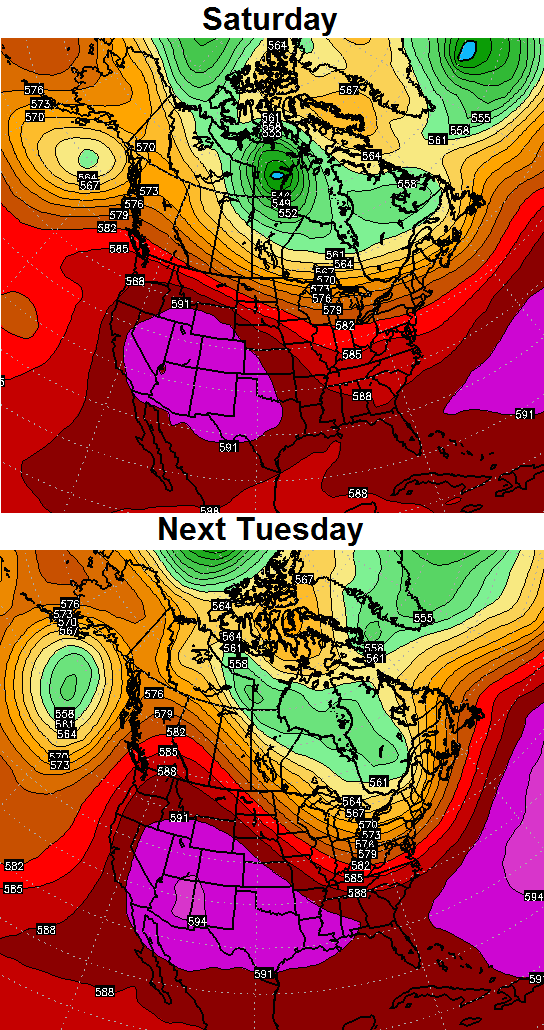
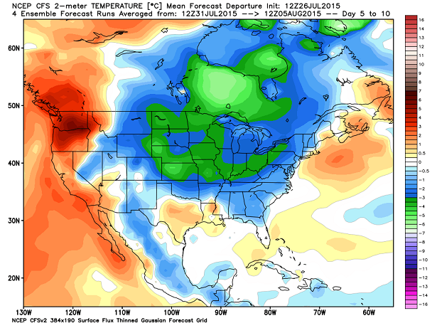
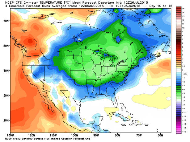
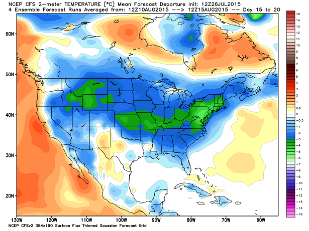
That knocks temps down on a strong northwesterly wind flow. You can see how the air coming in early next week is much cooler than normal…
That’s the beginning of what should be a very cool first half of August for much of the country. Watch the progression in 5 day increments…
 If you’re a fan of typical summer temps… Enjoy the next couple of days. 😉
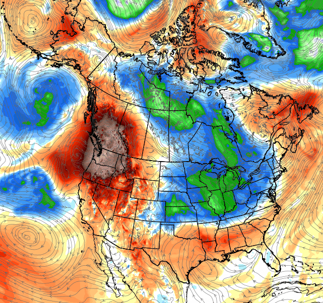
I leave you with your tracking toys of the day…

Current watches

Possible watch areas 


Have a great day and take care.

Thanks Chris. The weekend was nice! I know it was hot but, it’s July. It’s supposed to be hot! A little bit and miss rain would be a good thing. We have actually been dry since (dare I say it) last Wednesday. It’s been a while since we’ve strung together that many on a row! Oh well, it’s Monday so make the best of it and have a great day everyone!
A week-long dry streak is probably a good thing. If it extends more than two or three weeks, we might get concerned.
Here is a forecast I woke up to this morning on my TV. Station in the Cincinnati market:
Saturday – 90
Sunday – 91
Different meteorologists on the same station had been reporting a bit of a cool down for late in the week which is sort of in line with what Chris has been hammering home for a little while now.
Also I am wondering if the first part of August will continue to be wet or has that finally settled down?