Good Wednesday to one and all. We have a cold front moving into the region today and this front will produce some additional rounds of thunderstorms. This front will also usher in a much better brand of air as we close out July and say a hearty hello to August.
Steam and storms will be the main players out there today. Temps will be around 90 degrees, but humidity levels will make it feel quite a bit hotter than that. The storms that crank could be strong and put down a ton of rain. Local flash flooding is a definite possibility, again. Your tracking tools in a bit.
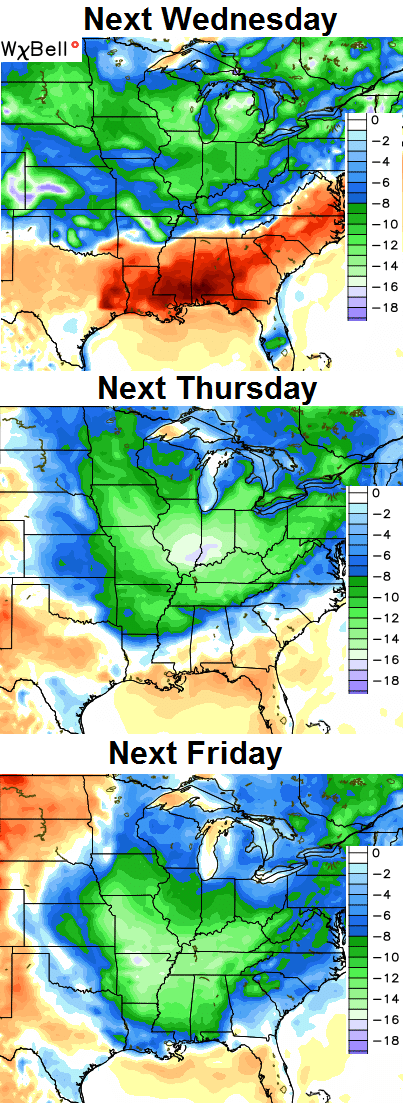
That front pushes to our south and east late Thursday. The early part of the day can still crank a shower or storm with the cooler and drier air sinking in as the day wears on. There should still be a nice temp/humidity gradient from north to south early on.
Friday looks pretty darn good with low and middle 80s for many with much lower humidity levels.
The first weekend of August will feature a mix of sun and clouds with pretty nice temperatures. I can’t rule out a stray shower or storm going up in this northwesterly flow. The readings will inch up a bit as we await the arrival of the next cold front early next week. That means an increase in showers and thunderstorms as the front slowly pushes in.
The air coming in behind that for the middle and end of next week…
 Let’s track today’s increase in storms…

Current watches

Possible watch areas 


Have a great day and take care.

Thanks Chris. Weekend looks spectacular! Looking forward to it and to some nice but not sticky weather. Didn’t we do this last summer? Hope that we still get some good hot August weather. Not ready for fall yet. Have a great Wednesday everyone. Happy Hump Day!
Looking forward to a few days of awesome weather before reality sets in and school starts back on August 12th! This teacher needs one last hoorah outdoors before it all begins again
Well it has been a little cool this summer, but certainly not as cool as last year with all of those 50 degree nights we had in July! Also, June was warmer than last year. We will have to wait and see how cool August is as most are not ready for fall yet.
I’ve been ready for winter since the last one ended.
Heat indices in Louisville are absolutely brutal anywhere between 101-106 feel like temp depending on where your at in the county.
Depending on where you’re at in far Western Kentucky, your Heat Index may be over 110. That is stinking hot.