Good Saturday everyone and welcome to August. The month is off and running on a very nice weather note across the bluegrass state. It’s looking more and more like the nice part of the weather program may not be sticking around very long. The stormy setup we’ve had much of the summer is trying to force its way back into the bluegrass state.
Today will feature temps down a few degrees from what we had on Friday. The low humidity levels remain, but there is also a small threat for a popup storm or two.
Readings bounce back to typical early August numbers later Sunday into early next week. This is ahead of a couple of cold fronts on the way next week. These will bring scattered storms early in the week, but the greatest concentration comes during the second half of the week…
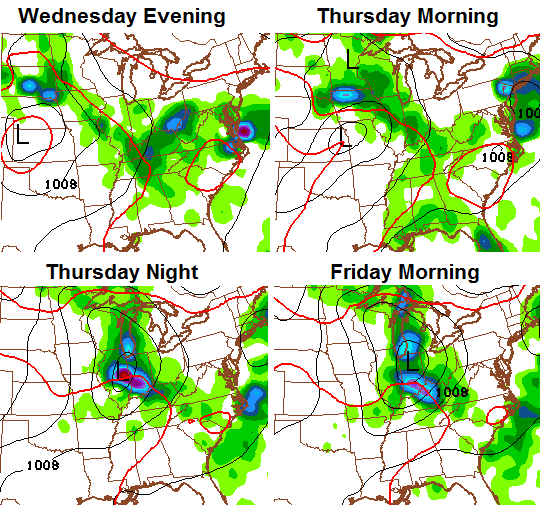
That’s a very unsummer looking system working across the Ohio Valley. Showers and storms are forecast by the GFS and European Models to become fairly widespread during that time. That’s being pushed by a significant dip in the jet stream that allows much cooler air to dive in here…
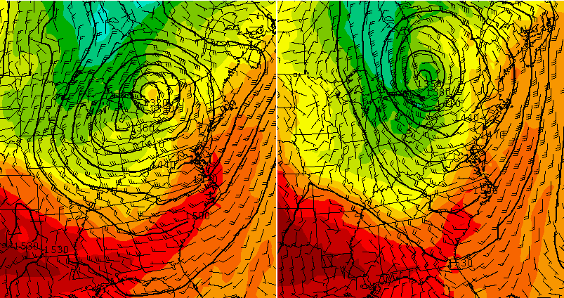
With a northwesterly wind flow, another system or two will try to dive in here a few days later…
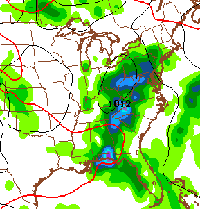
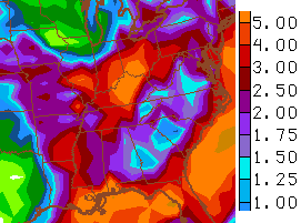
That setup is obviously can skew numbers cooler than normal for a while, but can also cause some additional rounds of heavy rains. The GFS rain forecast shows some high totals…
Make it a great day and take care.

Chris – remember back in March when you said it was your least favorite weather month? I can’t decide which is my least favorite – but it’s either August or Sept. Both are pretty boring weather months – much more boring than March (at least usually)….although one of the worst thunderstorms I remember was in Sept here in Lex.
August is my least favorite weather month. I like September because that’s when we start tracking the first decent cool shots. July is sort of dull but is stormy at times and hot. February and March are my favorites!
Pictures perfect day in the Commonwealth of Kentucky. Yes rather warm in the sun but find yourself a nice shady tree and with a nice breeze you can’t beat it.
A few weeks to soon, but I love the weather today. Not to hot, not to cold. I’d rather have mid 80’s during the day and low 60’s at night year round.