Good Wednesday, everyone. A dynamic system will cross the state over the next few days and deliver another big rain event. This could cause flash flooding across parts of the state. It’s part of an overall very active setup that continues over the next few weeks.
Scattered storms will increase today and some of these could be strong. Hail and high winds are the main players. Any storm that’s out there will produce a tremendous amount of lightning and rainfall. Local high water issues are possible, again.
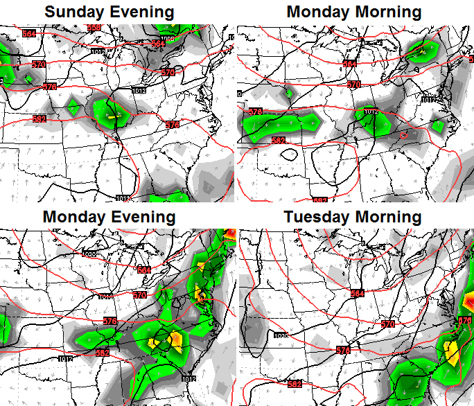
Widespread rain and storms will sweep in here later tonight into Thursday. That action will hang tough into early Friday morning. Much of the region can pick up a general 1″-3″ of rain with locally higher amounts. This will lead to an increased flash flood threat, so keep a close eye on water levels.
Highs on Thursday will be in the 70s with upper 70s and low 80s on Friday as our skies dry out.
The weekend starts good on Saturday, but will end with scattered storms going up later Sunday. That’s ahead of another system diving in here from the northwest…
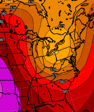
Check out the HUGE dip in the jet stream on the European Model…
That leads to some very cool readings showing up on the same model run…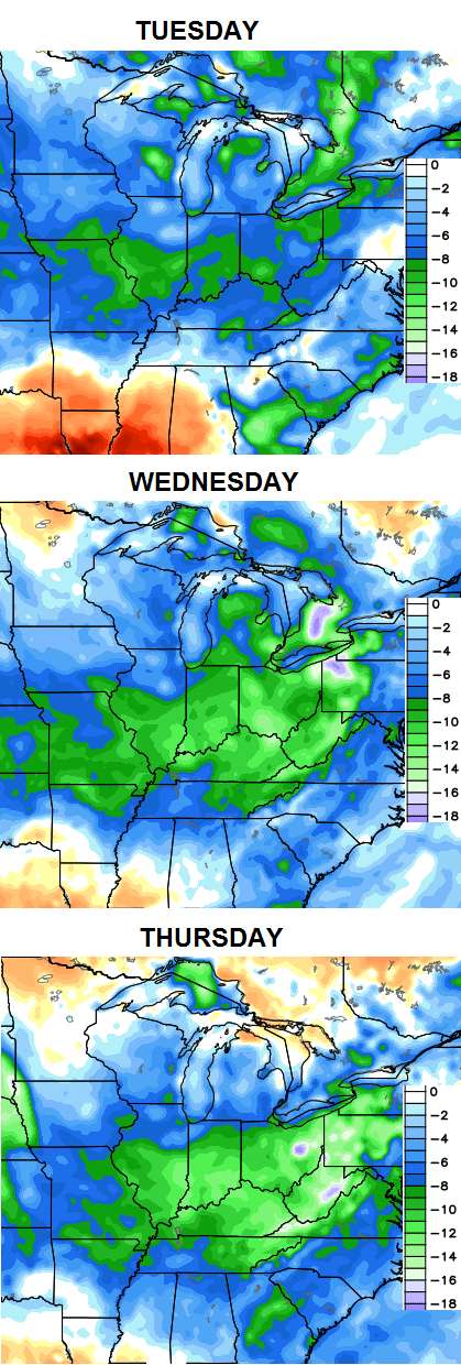 This ain’t your momma’s August! 😉
Let’s track what’s out there today…


Have a great day and take care.

A little winter talk while it rains… NDJ 2M temps and precip…..Not a bad look
http://i.imgur.com/Zafnxmk.png
http://i.imgur.com/nteGAFc.png
It appears that the entire state will likely get soaked this time, instead of the hit and miss deluges that have been occurring lately. Watch the radar fill in from west to east!
As of 7:10 tonight, there hasn’t been 1 drop of rain in my part of Georgetown today, at least behind Kroger. We did have a bit of thunder off in the distance earlier.
I have only had 0.30 in my back yard in Knox County but I am pleased with that result. It’s much better than 3 inches of rain
Now, there’s something you don’t see every day…Frankfort had the highest temperature in Kentucky today (89.9 – Mesonet).
Hello Chris, any thoughts on possible weather conditions for Saturday, Aug 15th….as we are hosting a High Scholl Girls golf tournament, here in central KY….Thanks for all you do….