Good Friday, folks. We’ve made it to the end of a week of weather straight outta September. I still can’t find any true summer heat, but the pattern will begin to skew warmer than normal in the coming weeks. As temps rise, so will the chance for scattered showers and thunderstorms.
A storm or two will try to pop today across southeastern parts of the state. The best chance will be for those counties along the Virginia and Tennessee borders. The rest of the region should stay partly cloudy with highs mainly from 80-85.


A weak upper level system looks to hang around the are this weekend…
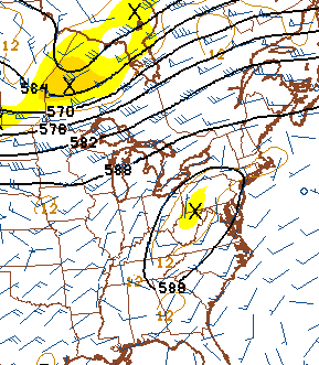
That could lead to a few scattered showers and thunderstorms going up. The NAM has been showing this chance for several days now…
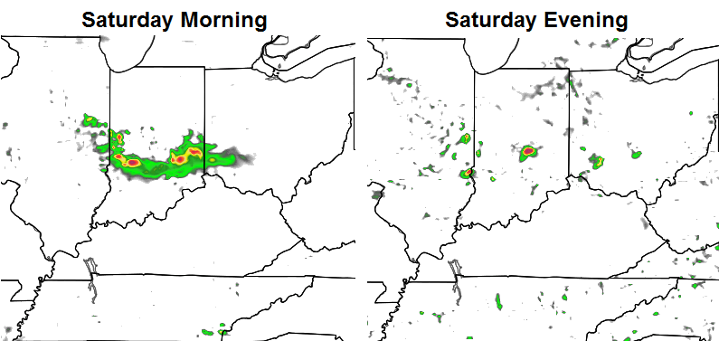
That’s certainly nothing widespread, but some scattered showers and storms will be possible Saturday and into Sunday. Highs will be in the low and middle 80s.
The upper flow continues to come at us from the northwest next week and that means the threat for more in the way of scattered storms. A weak cold front approaches the region on Tuesday with a bit of an increase in the action…
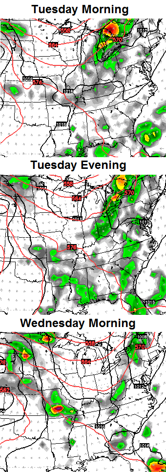
Another front may move our way by the end of the week.
The overall pattern is expected to skew warmer through the end of the month and into early September. The 10 day departures from the CFS are showing this well…
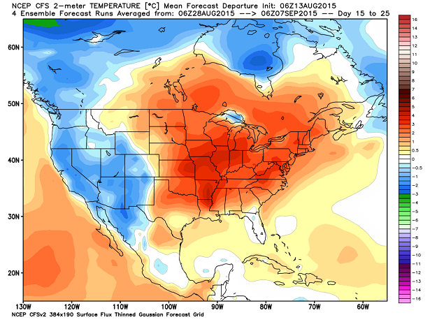
That same run shows a nice reversal by the middle of September…Have
 Have a great Friday and take care.

I just received a heavy, pop-up shower in Harlan Co.