Good Friday to one and all. We have one more absolutely gorgeous fall weather day in the works before changes move in for the weekend. These changes mean an increase in showers and thunderstorm chances as our pattern begins to warm. The tropics are also alive and well and I take a look at that. Plus, we take a longer look into the fall.
Highs today will be in the upper 70s to around 80 across much of central and eastern Kentucky. Low 80s will be in the west with a mix of sun and clouds. There is the smallest chance for a popup storm in the far southeast this evening.
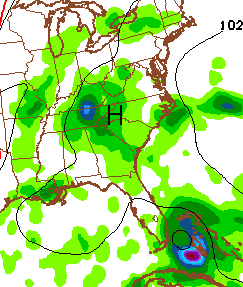
Saturday will see moisture and temps increasing with the threat for a scattered shower or thunderstorm. The storm threat really ramps up on Sunday as we see a hint of a tropical connection showing up. Juice increases from the south and southeast as Erika approaches Florida. You can see this on the NAM…
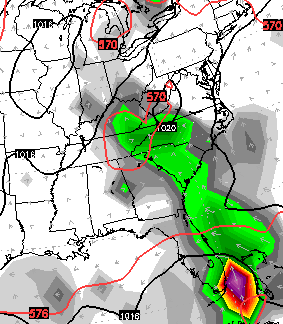
 That connection shows up a littler better on the European Model…
 The weather for next week depends on what happens with Erika and the models continue to be all over the place. This system heads toward Florida later this weekend and then we will see where it goes from there. Here’s the latest from the Tropical Prediction Center…

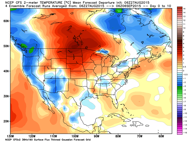
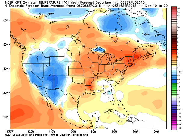
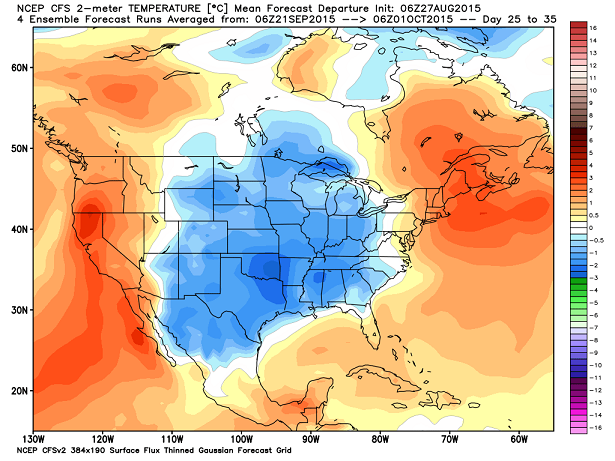
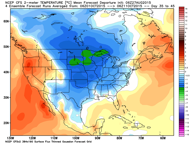
Looking deeper into fall with the CFS shows our warmer start to September, but some chilly changes later in the month and into October. These maps are 10 day increments…
 I’m telling you, this is going to be a bear of a fall and winter forecast. No true analog years to what’s going on right now means I have my work cut out for me. I’m ready to rumble… let’s roll! 🙂
Have a great Friday and take care.

Thanks Chris. Just need to keep good weather in the south till the middle of October and we get back from vacation.. The past few days have been amazing for August and even though that work thing has been happening ice enjoyed then a lot! Hope everyone has a great Friday! Enjoy the day!
Hoping for a winter with lots of snow!
Thanks CB
The current Erika path is definitely shifting a bit more towards the west which could favor a rainier forecast next week. All I can say is that this has been a spectacular stretch of both cool and dry weather lately, so if we have to go back to the rainy pattern, at least we did get a nice break before summer has come to a complete end!
I have spent some time out in the sun this past week. Not too long, but I think your body needs some sun, so I try to take advantage of that when we have it…….Each day this week was a little worse than the day before it…..It was so pleasant early, even with full sun, and today, that sun was HOT!
85 and Sunny here South of Corbin !