Good Monday, everyone. August is running out of hours and we’re just about ready to say a hearty hello to the 9th month of the year. Summer temps and scattered storms will be the rule for the first week of September, but cooler changes are already showing up.
The weather from today through the upcoming Labor Day Weekend won’t feature a whole lotta change. Steamy temps with a daily chance for scattered storms will highlight the daily forecast. Yawn.
A cold front approaches the region from the northwest on Labor Day and could move through here next Tuesday…
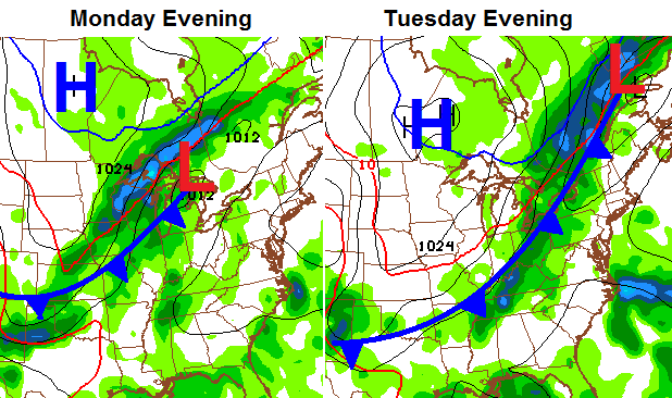
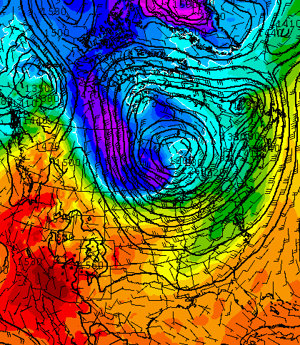
Pleasant air will likely follow that front into the middle of next week. It’s during that time that we find the Canadian Model with some serious chill across the high plains and northern Rockies…
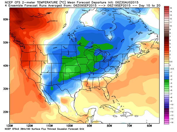
The recent trend on the medium range models is for a series of fronts to sweep through here around the middle of the month. For fun, the GFS long range shows a healthy cold shot building in southern Canada in 2 weeks…
I only show that because it matches what the latest CFS is showing around the same time. After a warm start to September, check out the 10 day temperature anomalies that follow on the model…
September, of course, is a transition month from Summer to Autumn. For weather purposes, we find the jet stream wavelengths slowly starting to change. This generally means changes to the overall pattern may not be signaled to far in advance. Just food for thought.
I leave you with your manic Monday tracking tools…


Have a great day and take care.

I know we’ve technically got another 20+ days of Summer to go, but it’s on the way out! Fall is knocking on the door and I, for one, am ready to welcome it with open arms. I’m excited to see what this upcoming Fall season will bring us.
And that means it won’t be long before the comments section will be rockin’ and rollin’ with snow lovers praying for an “old school” storm! I can’t wait!
Already there.
We’ve had “old school” storms the last couple years where I live…kinda done with those for a while.
Noooo…we need more:)
Come on, you can never have too much “Old School”!
Well – August has once again proven to do me proud as far as being the MOST BORING weather month….I’m not complaining as I do not mind the nice calm weather..but I can only take so much calmness before I need some weather excitement….nothing too dramatic though.
North Madison has missed the rains and about two weeks without any. Even boring from that regard.
“Old School”, did I hear someone say “Old School” When? Where? Surely not in my part of Madison County – the KY River fence and all that… … … Snow day? Snow day? Franklin county and L’burg gets all the snow – well Mason county gets too much as well… … … What about the goat? I still don’t know what Rolo’s goat has to do with the “s” word but it doens’t really matter – Rolo will probably change his mind four times if I asked him anyway!
I’m just getting warmed up for the season!
Where is Rolo? He talked old school and then right before we got smacked he reverted and said it wasn’t happening and we were done or the winter. Maybe he took a forced sabbatical from meteorological prognostications 🙂
I know, right?
I still look back and can’t believe after all those years we ended up getting smacked hard twice within 3 weeks.