Good Tuesday, everyone. The new month is off and running on a very steamy note and that’s a sign of things to come. Temps take a walk on the very warm side and we will see a daily threat for a shower or thunderstorm. Basically, it’s a typical late summer setup for the next week.
August wrapped up cooler than normal across the entire region, and many areas came in drier than normal. Take a look at the numbers for the month…
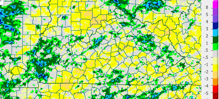 As you can see, there were still a lot of pockets of above normal rainfall, but a lot of areas were drier for a change. This is welcomed news after the record rains of June and July… We really needed to dry things out and we’ve done that.
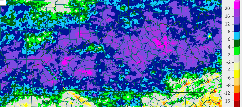
Even with the drier than normal August, the year to date is a soaker…
 One thing I’m watching for as we head into fall is the potential for an increase in fall forest fires. We have a tremendous amount of growth in the forests from all the rainfall, and we turn drier for a while, watch out.
The actual weather around here through Labor Day doesn’t really change. Steamy temps with a scattered storm or two. A cold front moves in early next week, and that’s something to watch for.
It’s also the time of the year the GFS likes to really show major cold shots in the longer range…
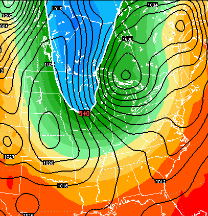 While the depth and the timing of these shots are many times fantasy land stuff, the model does usually show these as an indication of where the overall pattern is going.
I leave you with your radars to track any isolated stuff out there today…


Have a great day and take care.

The drier than normal was a nice change. I dug down for a post a few weeks back and it was still a swamp not to far down. Finally starting to dry close to normal levels and that is nice. Just hope the weather turns to a normal wetness and does not stay dry. Thank you for the update and have a nice day CB.
Wow! Harlan County is really the only county in the state with normal year-to-date rainfall totals!
This is usually the driest time of year anyway – so nothing is really abnormal – in fact when you look at the USA radar, it’s relatively quite everywhere.
Nope, we in north Madison are nearing three weeks with no rain.
I’m taking the hangman approach: drou_ _ _ 😉 🙂
Don’t follow JB much..He likes to ramble on way too much..Anyways here’s his winter forecast..Looks like Eastern Ky will be the place to be..lol
oops..
http://www.weatherbell.com/saturday-summary-august-29-2015
Thanks Chris. We could use a little rain. But I am not upset at the warm temps as we really have not had a bad summer. In fact it’s been wet and cool. But whatever we get I will take. Have a great evening all.
Well, we got over an inch of rain in just 40 minutes here. I guess we’ll be state champions for rain today….totally unexpected. Unofficial reports of a few trees down in the area but haven’t received confirmation or locations yet. Have a great night, all.