Good Saturday, everyone. It’s a hot and humid Labor Day Weekend and we all have a lot of things to do out there today. Chief among them… college football. So, I won’t bore you with some long-winded post, but will get straight to the point on where this weather pattern takes us.
Watch for a scattered storm or two going up out there today and over the rest of the holiday weekend. Outside of any storm action, you’re going to sweat. How’s that for direct?
Changes start to show up just after our Labor Day as a cold front works toward the region. The European Model slows this down and allows for a few waves of low pressure to develop along it. The model then brings a hefty storm system through here by Friday…
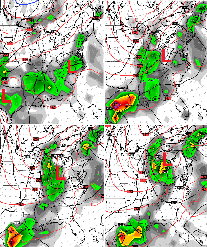
That scenario would bring some needed rains our way as temps turn cooler each day from Tuesday through Friday. Check out the drop as the front swings through here on the GFS…
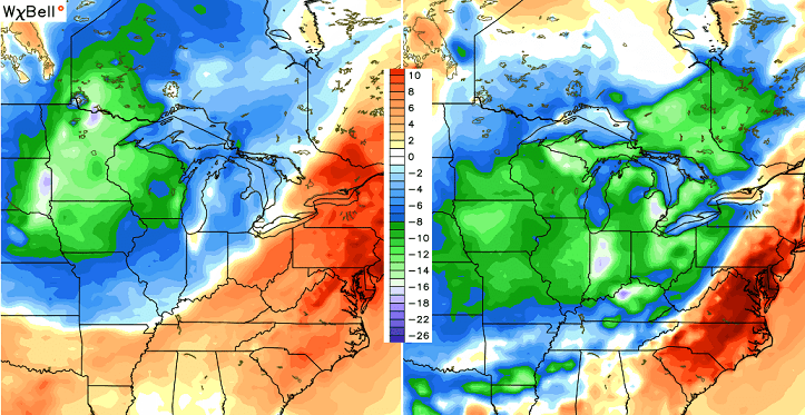
That MUCH cooler air then deepens across the region next weekend…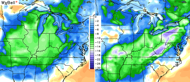 I wouldn’t be surprised if that isn’t followed up by another decent storm system developing across our region.
As you can see, fall is ready to fight back in a big way. I leave you with your scattered storm trackers…


Make it a great day and take care.

And GO CATS!!!!!!!!!
What causes the ‘ground clutter’ to be so bad on the radars at some time periods and not during others? I have noticed that this entire week has been bad for ground clutter returns which make it hard to see the precip, and this is not just on here but on all the viewing stations I have visited. What exactly causes this anyways…
Strange storms last evening. We had a heck of a lightning storm with close strikes that rattled the windows but not a drop of rain. I guess we were at the edge of the storm and that somewhere near us it was raining. We just got the scary stuff and none of the beneficial rains.
I remember back when I was a kid, my parents called it “heat” lightning. Here in south Taxington, we had two episodes of loud lightning. One around 7:00 and the other around 1:00 or 1:30 am. It also was very loud and window shaking.Around 9:00 last night the fish in my tank were going wild. Some would swim straight up and others straight down. I’ve never seen them do anything like that before.
Grace is born…Love watching the tropics this time of year..Really about the only interesting thing to do until October rolls around..Go Cats..
LOL…Is there ever a time of year without “strong cold fronts”?