Good Tuesday, everyone. Heavy rain and some thunderstorms are pushing across the region today. This system has some tropical juice to work with courtesy of the Gulf of Mexico. All of this leads us into some interesting possibilities later this wee into the weekend.
The rains out there today could actually cause some local high water issues. Some areas may pick up 1″-2″ of rain through tonight. The best chance looks to be across the eastern half of the state.
Leftover showers will carry us into Wednesday with some late day clearing in the north and west. Temps will be cooler. That cooler air presses in on Thursday with upper 60s and the chance for a few showers in the central and east.
The wild potential across the eastern part of the country starts Friday and could carry us into the weekend. A deep trough digs in across the east with low pressure developing in the mid atlantic states. The wild card in this is a potential tropical system in the western Atlantic.
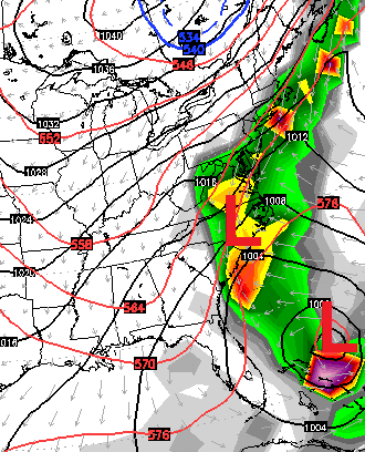 Many of the models show the trough digging in and capturing this system. They do differ on where this happens, but the European Model shows a quick capture with heavy rain and wind all the way into Kentucky…
 That scenario would obviously set the stage for a major event for areas just to our east with a lot of wind and rain for us.
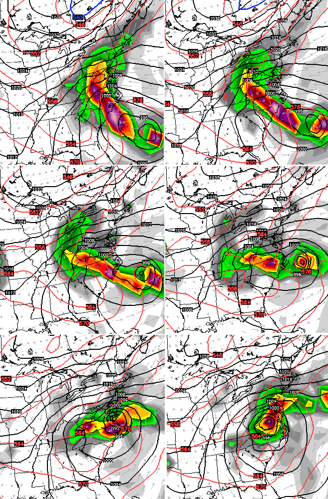
The latest runs of the GFS are slowly coming around to the “capture” scenario. The latest run of the model shows this taking place just a little farther north and east compared to the European Model…
That allows for a few showers in the east with gusty winds.
The Canadian Model is very close to showing what the European is showing, but JUST misses the early connection. It then makes up for it farther up the coast…
An extreme event across the east coast is looking more and more likely. Exactly when and where are yet to be determined. The same can be said for how much of an impact that system would have on our weather here in Kentucky.
Regardless, this is a VERY chilly air mass taking up residence around here for the first week of October. Any day that features clouds and showers would likely see highs in the 50s. Get some sun and 60s will be as good as it gets. Our first widespread taste of lows in the 30s is also possible during this time!
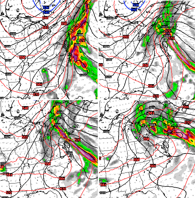
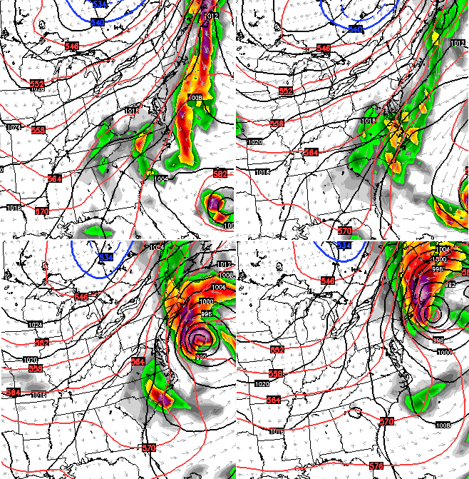
I’ve been warning you that the pattern was going to get a little crazy across the eastern part of the country. Things are certainly looking the part in the coming days.
I leave you with your rain tracking toys…


I will update things as needed. Take care.

Finally much needed rain is falling here in western, ky.
Sweet RAIN!!!
Major flooding event looking more likely for East coast later this week which will be bringing chilly temps and a lot of rain to our area too. Feels GREAT to fell the rain after this drought we’ve been getting into. But no flooding please!
WLEX doesn’t even mention the possible weekend stuff, sad case as what Bailey Boy been preaching is coming round on most model runs now,
Joaquin apparently is Strengthening ..Latest recon has eye wall forming..55kt/990mb..Interesting..
Some models suggest another Sandy situation but a less severe wind threat…interesting…
If this run of the GFS was to actually happen it would be an epic event..Lots of strong winds and rains..
Looks like the Gfs has the trough catching a hurricane and phasing it over the Mid Atlantis states..Someone is gonna get pounded if that happens..One run of many..