Good Wednesday evening, gang. Locally heavy rains continue across much of central and eastern as a system basically stays in place. This setup should carry us through Thursday.
The focus from there is on what happens this weekend. The two main players will be Hurricane Joaquin and a huge area of low pressure across the Mid Atlantic States. Will these two get together to form a blockbuster storm? Depends on which model you ask.
The European Model continues to show these two missing out on each other with Joaquin heading out to sea…
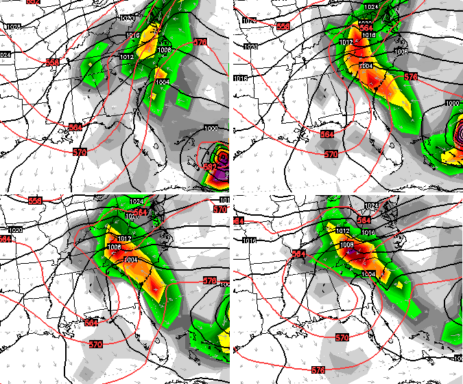
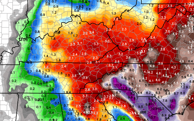
As you can see, that model still brings heavy rain and gusty winds to our region through the weekend. That same model run shows some hefty totals in central and eastern Kentucky…
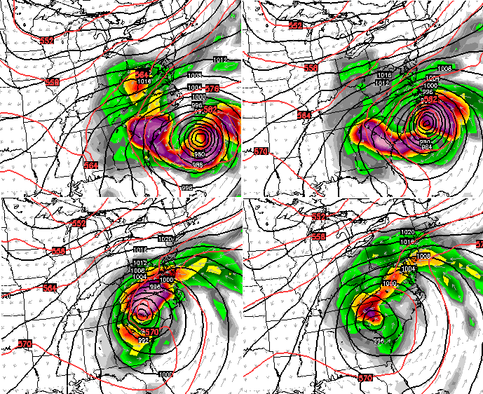
 The NAM also shows a miss…
 The same model run brings heavy rains from the east into Kentucky Saturday and Saturday night…
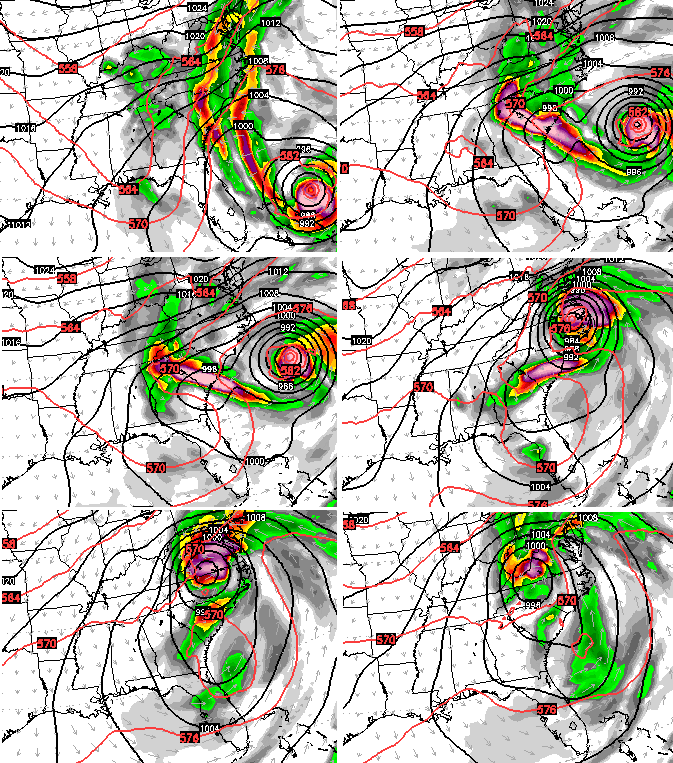
 Several other models show our east coast system and Joaquin making a weekend hook up. Here’s the Canadian model…
 The GFS model continues to show this well, but shifts around on when and where. Here’s the hot off the presses run…
 For Kentucky, it may not matter much on whether or not these two get together. Either way likely means wet weather and chilly temps for the weekend.
I will have another update late tonight. Your radars will carry you until then…


Enjoy the evening and take care.

I love stormy weather, so I am excited indeed. The only downfall to all of this wet weather is the effect that will result on the fall foliage. Oh well, I still prefer stormy over boring:)