Good Saturday, everyone. We have one heck of a gorgeous fall weekend in the making across the bluegrass state. Our lead cold front is now off to our east allowing for chilly air to blow back into the region. This is the first of many fronts over the next few weeks, and the overall pattern continues to trend toward what we’ve been talking about… Colder.
Highs today will be in the 60s with a mix of sun and clouds and a chilly breeze. There is still the chance for a shower or two in southeastern Kentucky before the skies clear.
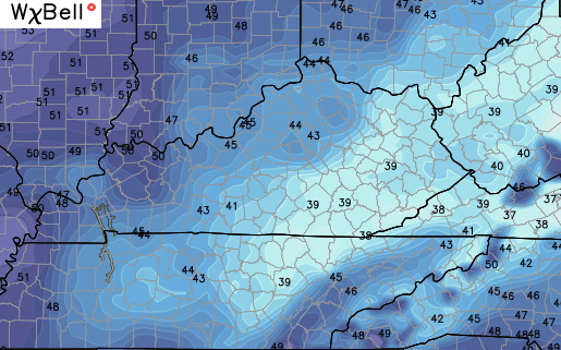
This sets the stage for a chilly night ahead with the potential for pockets of upper 30s to show up in some of the valleys…
 Sunday is great with temps pushing 70 under partly sunny skies.
The next “follow the leader” front moves in late Monday into Monday night with a band of showers and storms…
 That ushers in a blast of chilly air similar to what we have out there today.
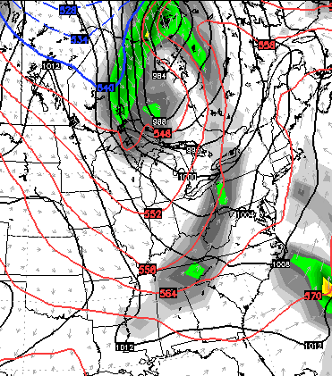
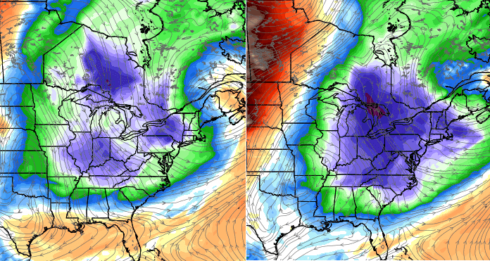
I’ve been pointing toward the end of next week into the weekend for the potential of a very cold blast of air moving into our region. The European Model is showing what looks like a clipper system zipping through the Great Lakes…
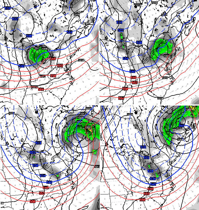
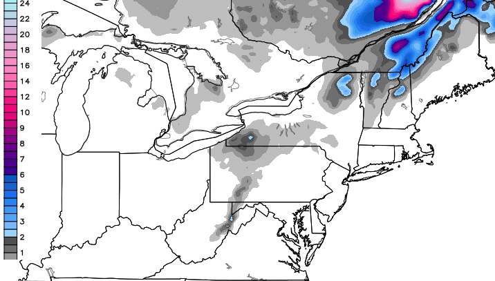
The same run of the European Model even brings the first flakes to the northeast and into the West Virginia Mountains…
That shot of MUCH colder than normal air engulfs much of the eastern half of the country…
 This gives us the potential for the first widespread frost of the season by next weekend. If the Canadian is right, a freeze would be possible…
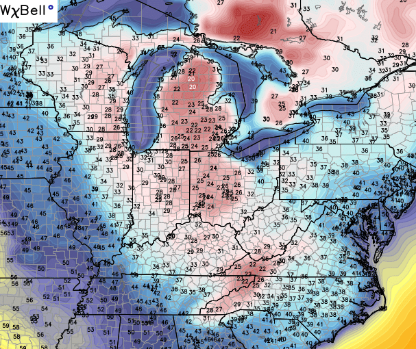 Ouch!
Ouch!
Make it a great Saturday and take care.

Bring on the cold!
Getting excited for some snow…maybe a lot more than some will want this winter:)