Good Monday and welcome to February. The month is off and running on a very busy note as we track the possibility of strong and severe thunderstorms. This action blows across the state on Groundhog Day and blows our recent mild spell out of town, with harsh winter weather lurking.
We have a band of showers and isolated thunderstorms rumbling across the region early today. This action slides by to our east as temps come way down compared to our weekend highs. However, the numbers will still be above normal for day one of February.
For the past week, I’ve been talking up the possibility of record highs and severe storms for Groundhog Day, and my thoughts haven’t changed. Gusty southwesterly winds help push a warm front to our north late tonight and early Tuesday. This allows for temps to absolutely soar…
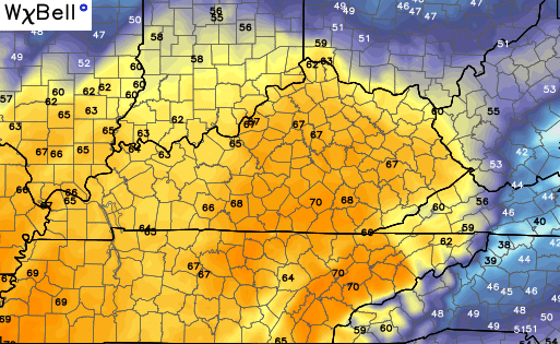
With enough sunshine, low 70s are a real possibility in several areas. This could very well become the warmest Groundhog Day on record for many cities across Kentucky.
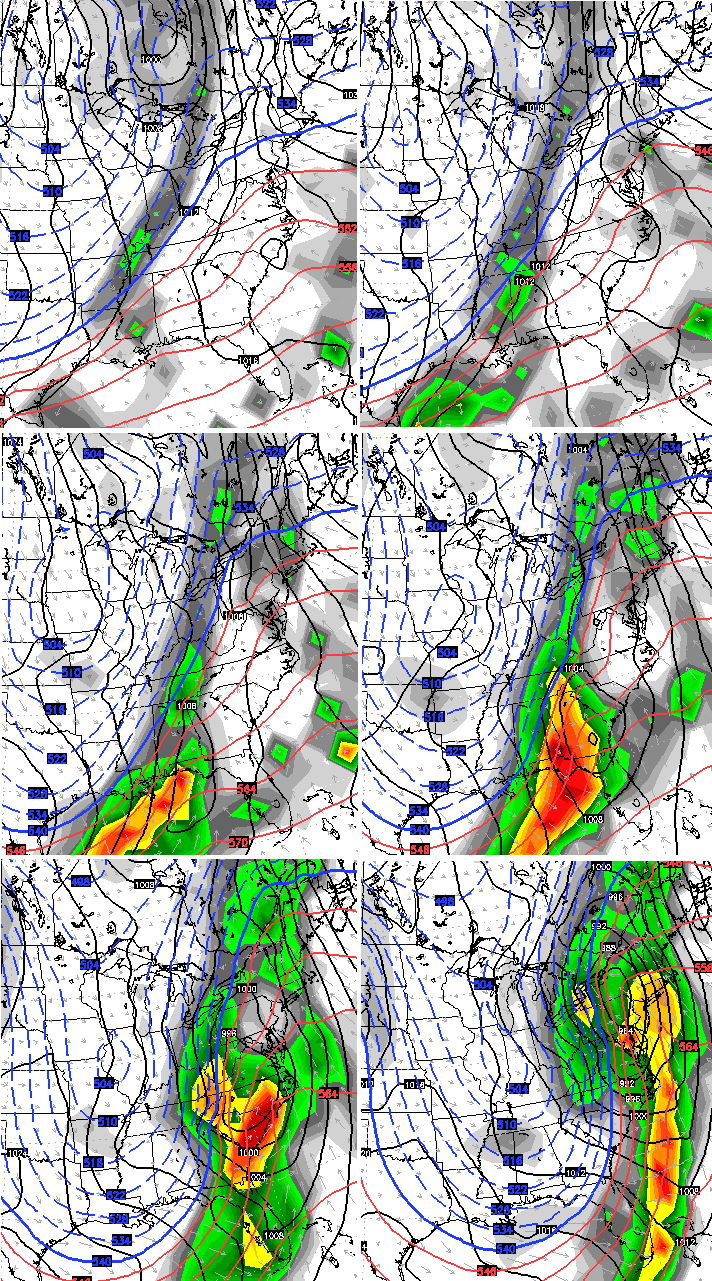
That kind of air during this time of year is often accompanied by the potential for big thunderstorms, and that’s exactly what we’re looking at. A line of strong to severe storms will crank by late Tuesday afternoon in the west and then surge to the east into the evening and overnight. Here’s the future radar from the Hi-Res NAM…

Damaging winds are still the main threat out of all this. Isolated tornadoes will also be possible. The Storm Prediction Center now has an enhanced risk for much of the state…

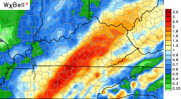
These storms will also have a lot of moisture to work with and could put down 1″-3″ rainfall amounts as they roll through here.
The GFS rainfall forecast…
The Canadian…
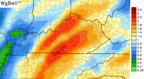
You can see how the models differ slightly on where the worst of the storms will be. Both seem to target central and south central parts of the state.
Tomorrow is a day to make sure you keep a close eye on the changing weather conditions. Of course, the blog will be set up to track the severe weather potential.
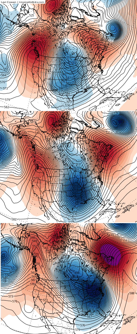
After tomorrow… winter comes fighting back into the region with falling temps on Wednesday. This leads us into another weak system diving in over the weekend. The bigger show looks to come early next week as this mega trough digs into the central and eastern parts of the country. Here’s the GFS…
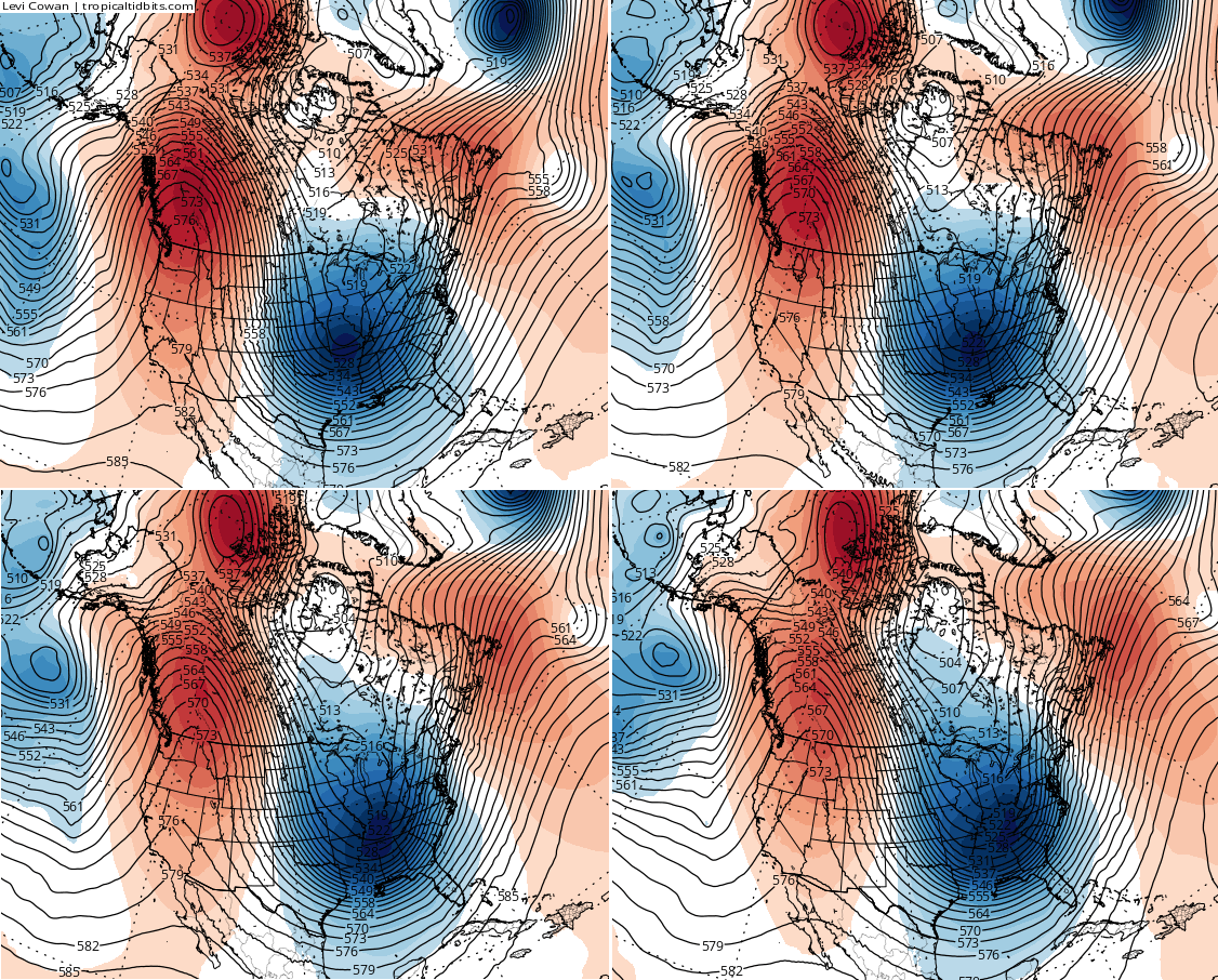
That look continues to be a strong one that can produce some wicked winter weather across much of the country. The latest run of the European Model shows a similar extreme solution to recent runs of the GFS…
I will have updates later today. Until then, let’s track today’s action…

Enjoy your Monday and take care.

The old adage continues to ring true … if you don’t like the weather now, stick around ….
Thanks Chris!!
A few lightning strikes this morning, including near London KY and into Tennessee.
A very small precursor to Tuesday.
February is going to have to carry the bulk of the cold for the region to have a below average winter, if you just count the December through February period. Anything’s possible. Last year, Louisville was 11 degrees below normal for February, the 7th coldest on record.
Louisville will need to average at least 11 degrees below normal for the month to go below normal for the winter.
The comment section always seems so dead when there isn’t snow in the immediate forecast. And when there is snow, it seems full of people saying “go away snow,” or people telling Mr. Bailey he is wrong.
You pegged it about as well as anybody ever has.
Wouldn’t mind seeing one more good snow before the season is out.
Snow or no snow…I read this blog almost daily. I love it!! Thanks for all the hard work you put into this Chris…and for keeping all of us informed of the weather…”whatever the weather, whether we like it or not.” Ha!
The overnight rain event went way beyond “some showers”.
Lawd, lawd, we gonna be in trouble again come spring.