Good evening, everyone. We continue to monitor the potential for severe thunderstorms late Tuesday into Tuesday night. The Storm Prediction Center continues to show a slight to enhanced risk across most of Kentucky…

Here’s a breakdown of the day:
– A warm front lifts northward across the state and could produce a shower or two as it does so.
– Record high temps will be possible with many areas flirting with 70 degrees before the afternoon wraps up. Temps will stay in the 60s through the evening.
– A line of strong to severe storms develops across western Kentucky by late in the afternoon or early evening. That line works eastward into Tuesday night.
– Damaging winds continue to be the main threat. Isolated tornadoes can’t be ruled out… Especially across south central Kentucky.
– With or without thunderstorms, high winds are going to be a problem. Gusts to 50mph will be possible with such a strong system. With a soggy ground from recent snow melt… some trees may come down.
– I’m a little more concerned about the local flash flood potential. A 1″-3″ rainfall will be possible with these storms in a short amount of time.
The setup for next week continues to show an extreme look at 500mb. Here’s a look at the European Model from WeatherBELL..
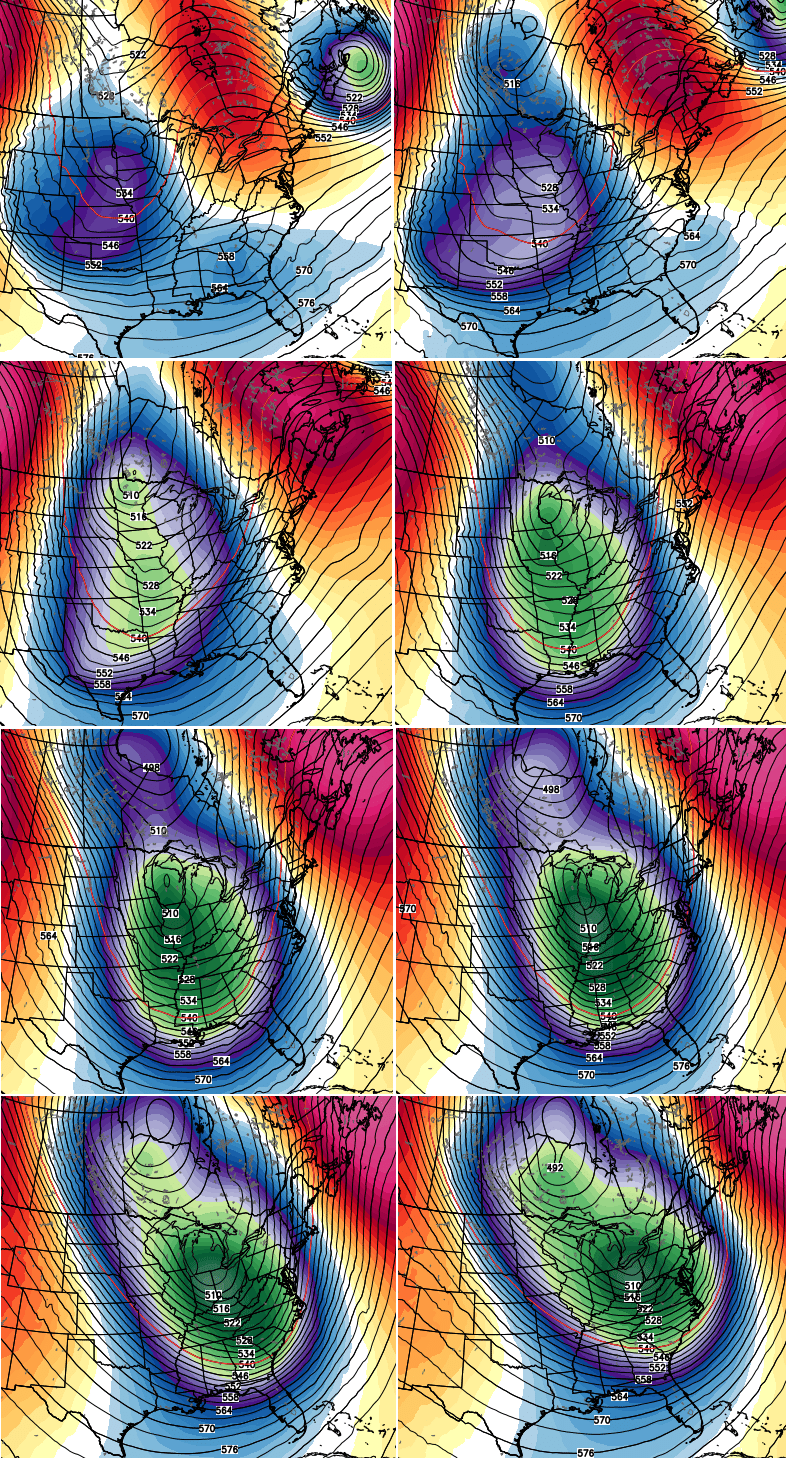
The surface maps change from run to run on each model, which is why I’m generally focusing on the upstairs look. What this brings our way remains to be seen, but there is a ton of harsh winter weather potential with that kind of signal.
I’ll see you later tonight for an update. Enjoy the evening and take care.

It will be interesting what happens after this system moves through. The Louisville mets, that I watch, are saying a brief cooldown, after this system, then back into the 50`s for Thursday through Saturday. Then 40`s after that. They said another brief shot of cold air after that.
They did mention a southern system shows up early next week, but that will be rain for the southern states. Their key word was brief.
I read this blog daily for a reason.
Maybe my eyes played tricks on me but, didnt the SPC have the enhanced risk a little farther east than it is now at one point? Where it is now seems to be where it originally was sometime yesterday morning. I dont know!