Good evening, everyone. Rounds of snow showers and squalls continue to push across the bluegrass state. This action continues through Tuesday with additional snow showers coming on Wednesday. All of this action will continue to “nickel and dime” us with accumulating snows.
A heavier band of snow should setup tonight across the Interstate 64 corridor and points north. That doesn’t mean the rest of the area doesn’t get snow, it’s just an area of greater potential developing.
Additional rounds of snow showers and squalls will take us through Tuesday and into Wednesday. Most areas will pick up a general 1″-4″ snow during this time, with locally higher amounts. Snowfall… not snow depth. Bitterly cold temps arrive Wednesday into Thursday with wind chills that may drop below zero at times.
The European Model continues to show a snow system for Friday into Friday night…
 That unleashes another round of arctic cold for the weekend. The European isn’t as strong with the Friday system and goes back to showing a stronger Sunday into Monday system…
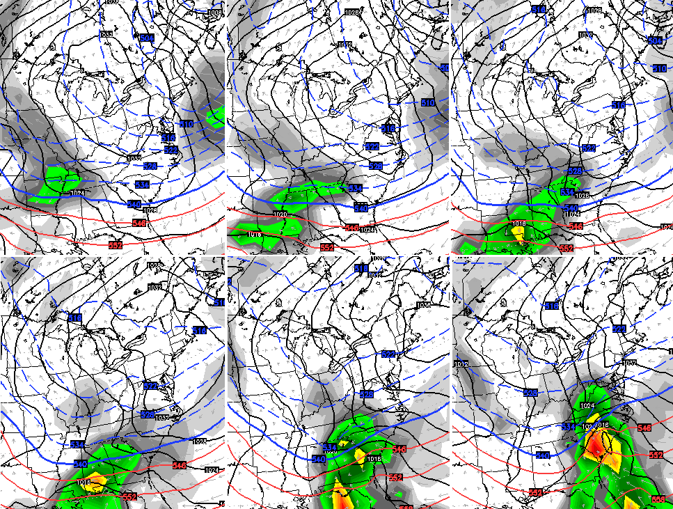
The Canadian Model still shows it…

The European Ensembles average snowfall over the next week likes our region…
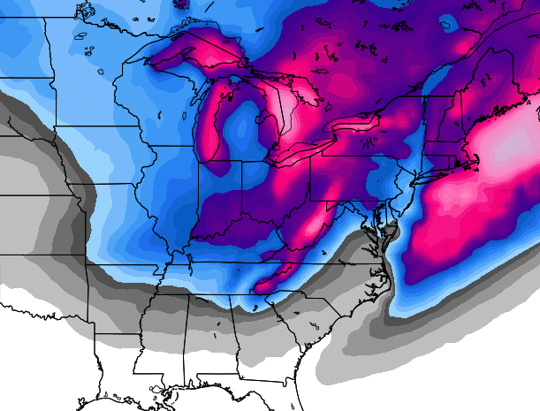
I leave you with your snow tracking toys…


Hamburg Area from WKYT Studio
Lexington

I-75 @ Winchester Road
Lexington
I-75 @ Iron Works Pike
Lexington
I-75 @ Clays Ferry Bridge South
Between Lexington and Richmond
US 60 @ US 127 Frankfort

US 60 @ US 460
Frankfort

US 60 @ Chenault Road
Near Millville

I-75 MP 127
Georgetown
I-64 MP 97
Winchester
Mountain Parkway near Slade

I-71/I-75 at I-275
Near Covington

I-275 at Mineola Pike
Near Covington

I-275 approaching KY 20/Airport
Near Covington

Bluegrass Parkway Bardstown
I-65 MP 32

Downtown Louisville @ 2nd & Broadway
Louisville

I-64 @ I-264
Louisville

I-264 @ Freedom Way
Near Louisville International Airport

I-75 at MP 36
London

I-75 at MP 23
Corbin
-65 @ 234
Near Bowling Green

Natcher Parkway MP 5
Near Bowling Green

Enjoy the evening and take care.

Ok so fayette county snow day for Tuesday, over under chances??? P.S. We love you and may refer to you as our boyfriend (we’re totally happy and married but that’s how important this is)
Is this my wife Anna?
Wait, Anna is married??!!
I love how at the moment the snow is just disappearing as it gets to Lexington and redeveloping on the opposite side… I mean can we get anymore snow dome than that? Sigh.
so will the radar fill in later tonight? its not very impressive at the moment
Looking for the snow. Patiently.
Snow tapered off for a little while on the eastern edge of Louisville, but picking back up now. Coming down steady and has been sticking to roads for a while now. Winds are really gusting too.
If you are already giving up on the snow here in SE KY–don’t! I have received over a half an inch in about 20 minutes here in Harlan with the upslope starting to really show up nicely on radar. Only an inch on the ground, for now:)
Hot spots for snow seem to be in south west Ohio and around Nashville TN
Looks like Southern Ohio is stealing the banding of snow that Northern KY was forecasted to get tonight, unless some more energy moves in later. Appears that many areas North of Cincy are getting around an inch an hour right now!
We had about 15 minutes of rain/snow about 5 this evening. Nothing since then. Looks like the snow on radar is starting to break up. Not looking good East of Huntington WV right now.
Hey! What happened to Paducah camera?