Good evening, everyone. My time is short, but I wanted to get a post on as I run out the door to emcee Father/Daughter Date Night at UK Gymnastics.
Most of the models bring a healthy swath of snow across Kentucky Sunday into Sunday night. They really differ on what to do with Monday and Tuesday. The NAM snowfall map through Monday…

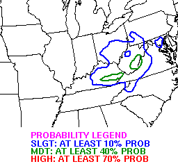
That shows a big hit for southeastern Kentucky since it keeps the Monday low nearby…
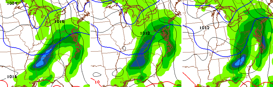
The GFS basically lost the Monday storm, but shows decent snows from Sunday into Sunday night…
The European Model is most consistent with the whole setup. Here’s the snow from Sunday through Monday morning…
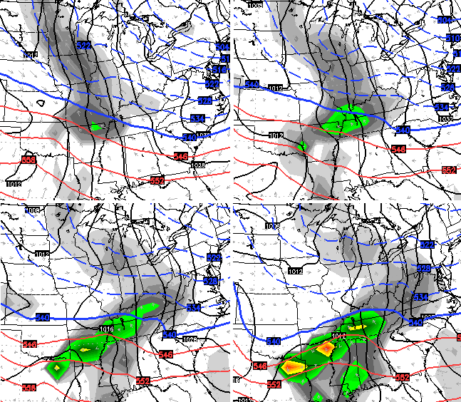
The model then really wraps up the storm system for Monday and Tuesday…
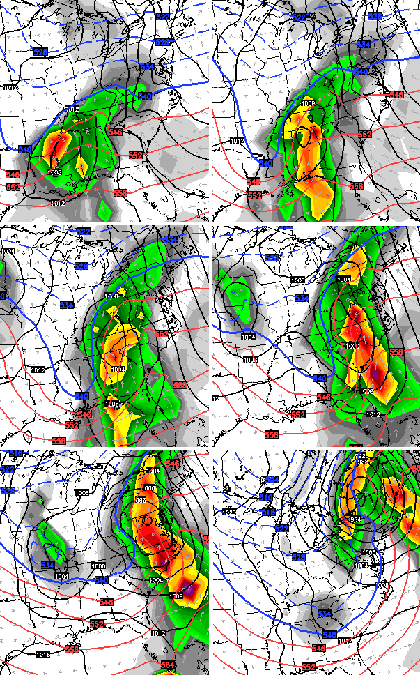
Verbatim… the model shows Sunday and Sunday night snow with a mix and rain for Monday then snow to end Monday night into Tuesday.
Complicated, isn’t it? 🙂
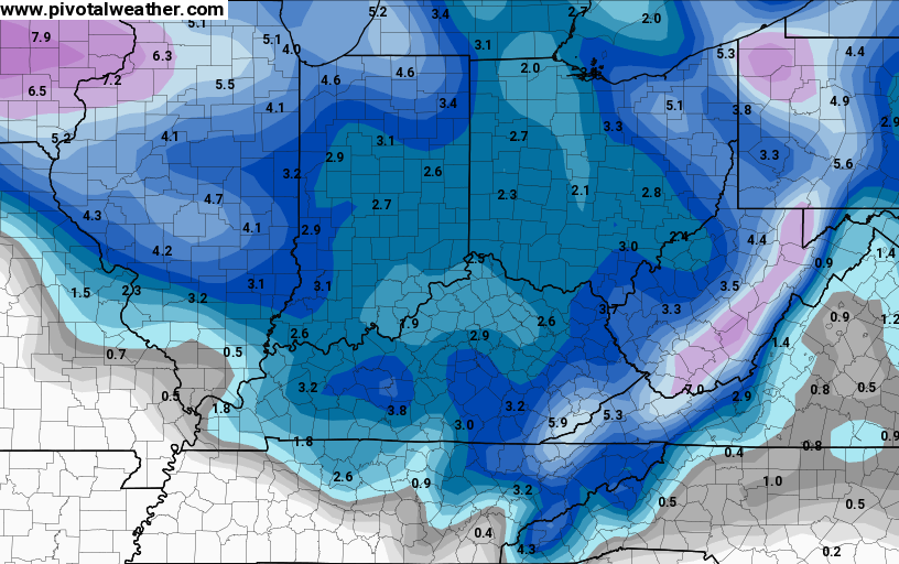
The WPC shows much of central and eastern Kentucky in the 4″+ snow risk from late Sunday into Monday…
 I will update things later tonight. Enjoy the evening and your tracking toys…


Take care.

Have a great father/daughter date night and thank you for the wx update.
Can’t wait to see the first call for snow fall… Hope it comes out soon! Wink wink nudge nudge
Chris had his first call for snow on the 4pm broadcast of the wkyt local news….check their website maybe?
How much was eastern ky suppose to get
Bet ya the track pushes back to the west!
THANKS SO MUCH!!! Your weather report has has help us prepare in taking a vacation day to going to the grocery store to get a gallon of milk before a big snow storm. Glad to know such a meteorologist as you. Enjoy your father/daughter dance. “PRICELESS”
I remember with the last big snowstorm, it looked like a big hit for counties near the Ohio River right up until 12 hours before the storm hit. Certainly, I enjoy seeing the latest models, but I’ve learned not to get too excited about predicted snow totals until the day of. Just when it seems like one area will get a big snowstorm, things change. That’s the way it goes. It’s very enjoyable to see all the models change and the comments on here.
It occurred to me today that the people in the neighborhood who are always *still* wishing for big snows are the same people who you never see helping those who need it with snow removal. I may make it my mission this go around to bury some people’s cars and driveways just to ‘help’ them get over their obsession.
Not to mention my 45-minute commute to Crab Orchard or 55-minute trek across highway 52 to Danville.
00Z NAM is interesting. I await the thoughts of Mr. Bailey.
Could someone please post the first call on here… Thanks in advance.
Actually, I wouldn’t mind if the Canadian model was right this time. The 2-3″ snow that NAM and GFS are predicting isn’t enough to drag out the snowblower so I’d have to shovel manually. Canadian’s rain and above-freezing temps would be fine with me…
Good luck forecasting this, CB. Seems to be no converging solution with the models yet, so perhaps not a biggie for us, but more east and NE.
I’m actually fine either way with this one. This is nearing the transition point of winter. Do we get a bonus snow or a warm up tease of spring?
,
My faith is dwindling. I’m near the edge. Someone save me. I’m teetering on the edge!
Will it snow!? It sounds as if no one knows!
I have a bad feeling it’s turning towards an annoying little ankle biter.
When is the next system coming in??? Ha!
I would not put too much stock in signiifcant snow with this unless far east KY. Models so far are meh and no agreement so far.
Mix and rain are also factors to further stunt much accumulation.
Don’t know what maps you’re looking at but the new model runs are pretty dang good for a good hit.
Direct me to the latest models, please. 🙂
http://www.instantweathermaps.com/NAM-php/showmap-conussfc.php?time=24&var=ASNOWI
The storm will finally make landfall early this morning. the twelve Z runs by the models will finally begin together important data. The track of the storm should be finalized by tomorrow evening.
According to Chris Bailey tweets the NAM, GFS and European models have shifted west the only one that is far fetched is the Canadian model
Been following the blog for around eight years now. Seen a whole lot of storms come and go by the life of the blog. This site has made winter weather enjoyable to so many. One thing I have learned is that not all meteorologists are the same. Not all can even be trusted. CB has put a huge portion of his life into this blog and I think we can all agree we are extremely thankful. I trust Kentucky Weather Center more than any other media outlet there is. CB truly is one that loves his work. Just wanted to thank CB for all the devotion he puts into our KWC family.
Hear, hear!