Good Wednesday and Happy New Year! As we begin a brand new year, here’s hoping 2020 is your best year yet! I know that is certainly my goal in all forms of life! 🙂 As far as the weather is concerned, we continue to track some big rains rolling in for the next few days.
Temps for day one of the new year aren’t bad at all as the sun returns. That will be short-lived as clouds roll back in this evening ahead of our big rain maker for the next few days.
As we have talked about for a while, this will likely bring another flood threat to much of the region. We have a saturated ground, our creeks and streams are already rolling and our rivers have been in flood. It won’t take much to get renewed issues to show up.
My current rainfall forecast continues to be the same…
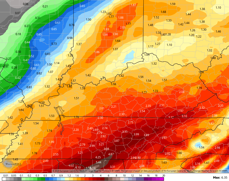
 The European Model continues to be similar to my line of thinking…
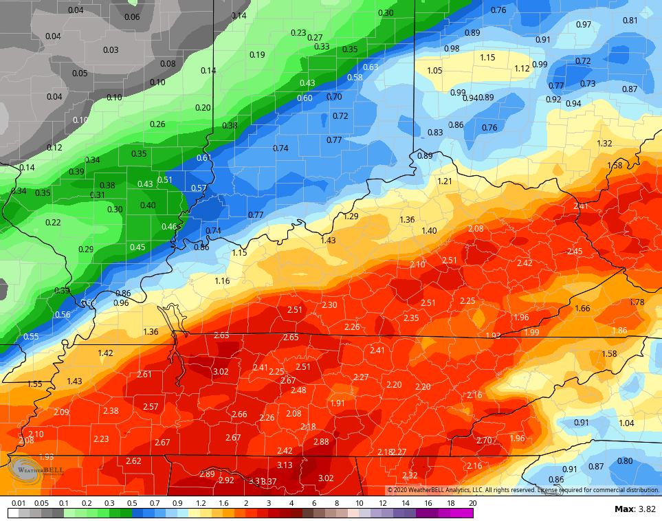
 The Canadian isn’t as far north and west, but targets the same areas with the heaviest rains……
 The ICON…
![]()
![]() If you’re using the GFS or NAM, you’re doing it wrong. Both models are struggling to grasp the setup properly. We have got to work on our American Models.
If you’re using the GFS or NAM, you’re doing it wrong. Both models are struggling to grasp the setup properly. We have got to work on our American Models.
Once into Saturday, rain is likely to change to snow. The European Model continues to be much more emphatic with the snow potential…
 The Canadian isn’t as amped up, but it’s not that far away…
 The system following that up by Tuesday and Wednesday of next week continues to show up differently on each model and even different from run to run. Watch for a farther south trend on the Euro…
 I will have your normal updates later today. Have a wonderful and blessed New Year. Take care.

Unofficially, or until the NWS makes the call, I have Lexington at 8th warmest December, Frankfort at 9th, Bowling Green tied for 10th, Paducah at 9th, Jackson tied for 7th, London at 8th.
Also, Paducah made a top 3 showing in the wettest year category and Bowling Green was easily in the top ten along with Jackson and London.
NWS already has flood watches up from Louisiana to East TN. I really hate how the GFS is constantly correcting at the last minute, mostly on lack of total precip and sometimes on storm position too and this has been worst ever with the new version. SMH!
Maybe perchance we get some brief wet snow accumulation as the EURO did do the best job 3 weeks ago when us far SE KY counties recieved that small, but very pretty snowfall!
That due east flow next week still seems odd. Seems would be more NE flow and the typical reason KY tends to be the transition point. We get back end snow scraps and the main action N and NE of KY.
I think it has been so bad for the past four years, that even back end snow scrapes are becoming exciting to track, LOL. I hope the EURO does as good with these two snow attempts as it did with the very far SE KY small snow event we had three weeks ago. Even though it will be a flash melt event due to very warm before and after temps, it would be nice to get something, anything areawide at this point in time.
Discouraging to see most of the models that showed some promising significant snow potential start to fade away as usual as 2020 arrived.
The new ICON really swamps Bell and Harlan with 4 inches of rain. I guess NWS is waiting to issue a flood watch based solely on the GFS as it has around 2 inches only areawide.