Good evening, folks. It’s a clear and calm night taking shape, but the forecast continues to focus on a big system for the weekend. That one is going to bring a lot of rain, wind, strong storms and the potential for record highs.
The Hazards Outlook from the Weather Prediction Center is super busy for our region…
 I like how the GFS is handling this system…
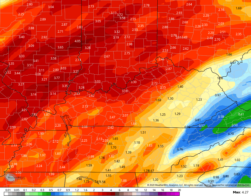
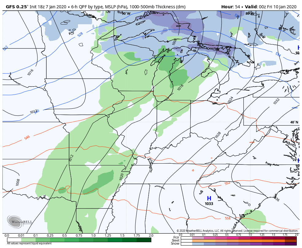 It puts the heaviest rainfall in the areas we are targeting across western and central parts of the state…
 We need the cold air across the western part of the country to overwhelm the pattern and change this up before we get ourselves into more high water troubles. The problem is, I’m having a tough time finding that.
Enjoy the evening and take care.

I agree Chris i just don’t see a pattern change when i thought there would have been by now, But all i can say is when it does change it’s going to be a brutal change!
Hey Terry, I think regardless who wins the total snowfall contest, for the season, either of us will be disappointed. Because i doubt neither one us reach double digits. I just saw the weekly predictions out thru the first few days of February. It’s more of the same warm/wet.